MyTopo
Halfway Wyoming US Topo Map
Couldn't load pickup availability
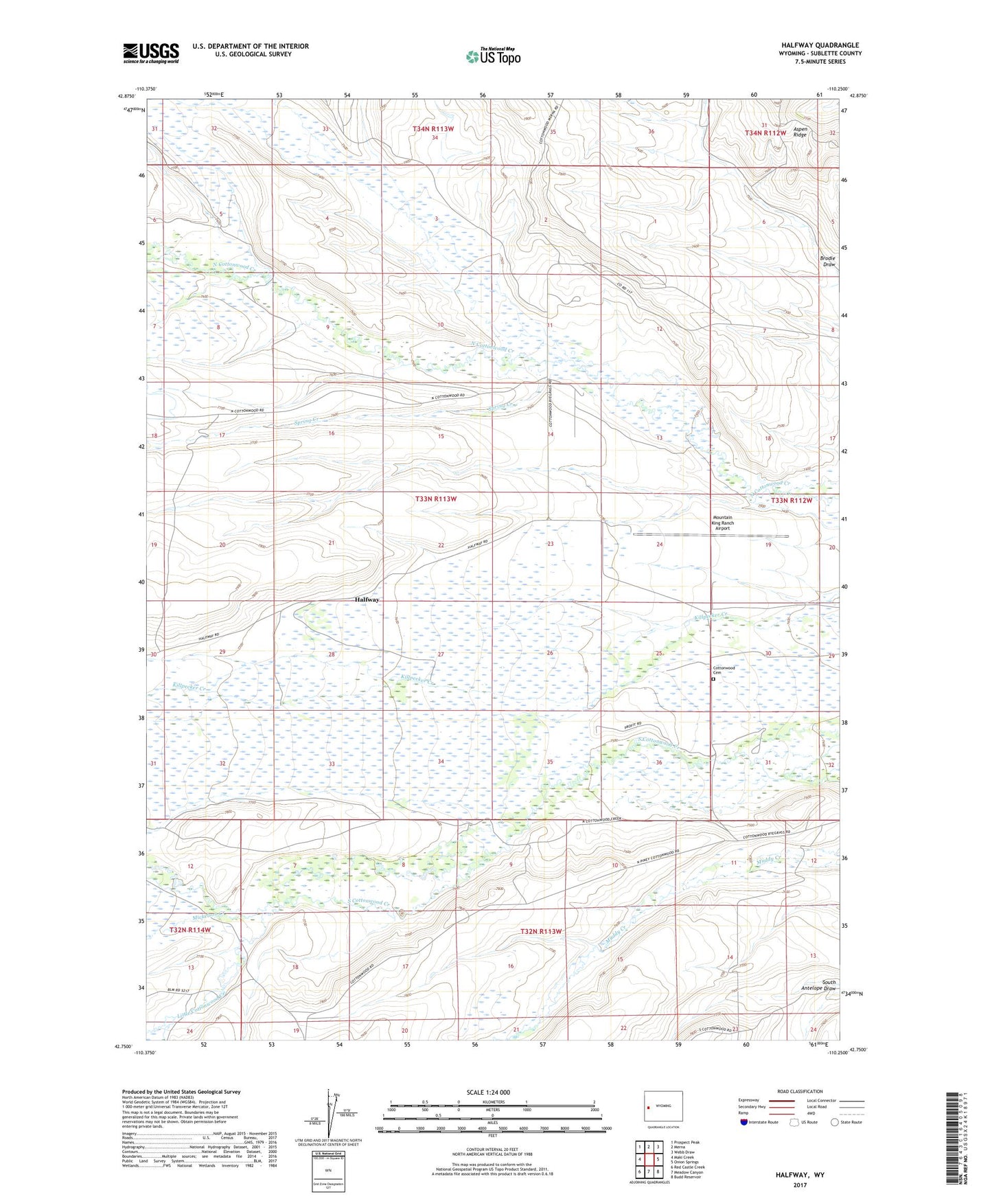
2021 topographic map quadrangle Halfway in the state of Wyoming. Scale: 1:24000. Based on the newly updated USGS 7.5' US Topo map series, this map is in the following counties: Sublette. The map contains contour data, water features, and other items you are used to seeing on USGS maps, but also has updated roads and other features. This is the next generation of topographic maps. Printed on high-quality waterproof paper with UV fade-resistant inks.
Quads adjacent to this one:
West: Maki Creek
Northwest: Prospect Peak
North: Merna
Northeast: Webb Draw
East: Onion Springs
Southeast: Budd Reservoir
South: Meadow Canyon
Southwest: Red Castle Creek
Contains the following named places: Beecher Creek, Cottonwood Cemetery, Halfway, Little Cottonwood Creek, Mickelson Creek, Mountain King Ranch Airport, Ryegrass Junction, Spring Creek