MyTopo
Herman Ranch Wyoming US Topo Map
Couldn't load pickup availability
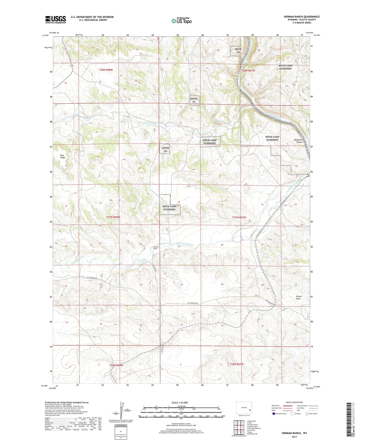
2021 topographic map quadrangle Herman Ranch in the state of Wyoming. Scale: 1:24000. Based on the newly updated USGS 7.5' US Topo map series, this map is in the following counties: Platte. The map contains contour data, water features, and other items you are used to seeing on USGS maps, but also has updated roads and other features. This is the next generation of topographic maps. Printed on high-quality waterproof paper with UV fade-resistant inks.
Quads adjacent to this one:
West: Coleman Butte
Northwest: Sibley Peak
North: Cassa
Northeast: Haushar Ranch
East: Guernsey Reservoir
Southeast: Wheatland NE
South: Dwyer
Southwest: Lewis Flat
Contains the following named places: Cold Spring, Herman Ranch, Little Cottonwood Creek, Pepper Ranch, Porter Rock, Russel Ranch, Snell - North Laramie River Airport, Wendover Canyon