MyTopo
Lewis Flat Wyoming US Topo Map
Couldn't load pickup availability
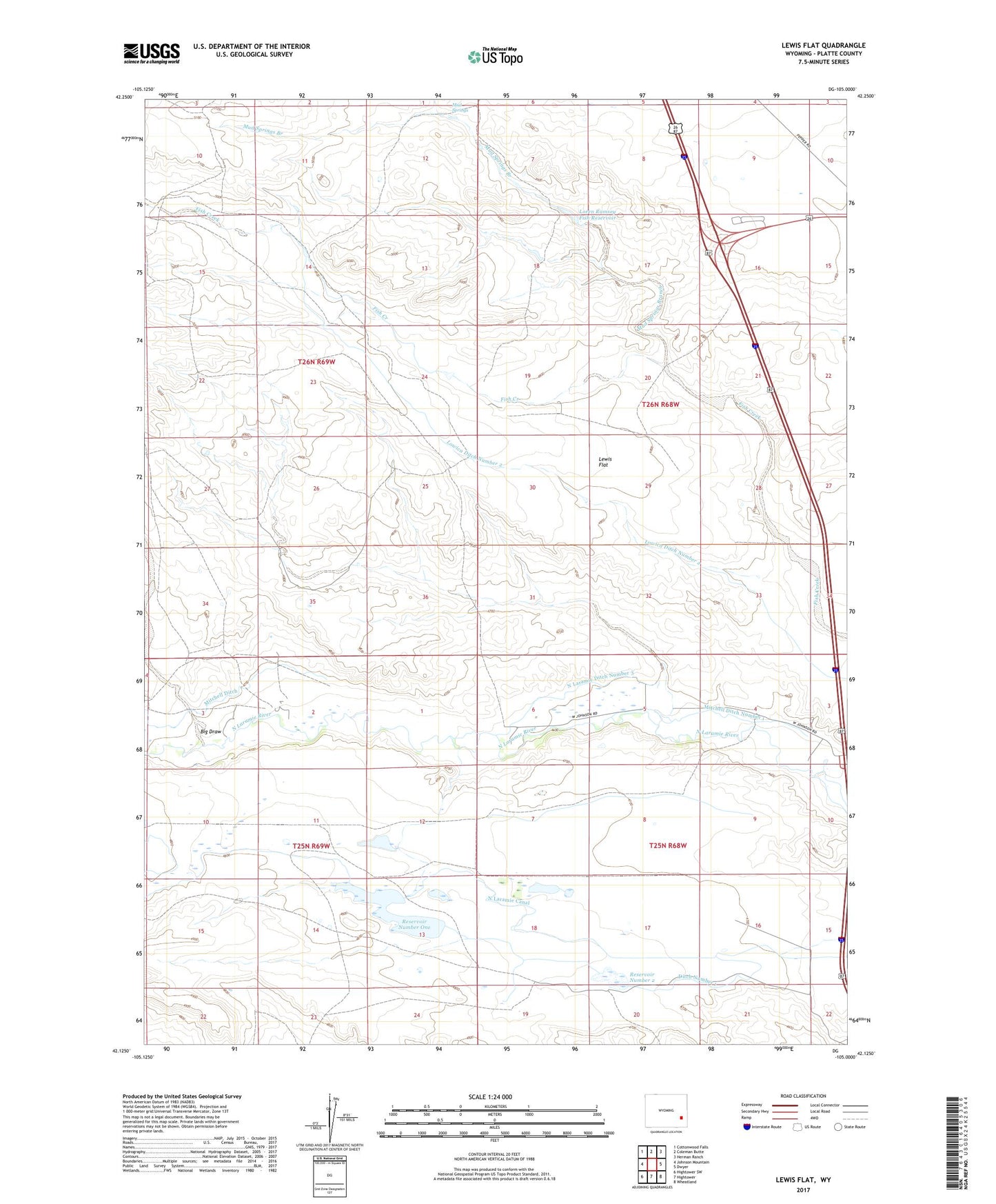
2021 topographic map quadrangle Lewis Flat in the state of Wyoming. Scale: 1:24000. Based on the newly updated USGS 7.5' US Topo map series, this map is in the following counties: Platte. The map contains contour data, water features, and other items you are used to seeing on USGS maps, but also has updated roads and other features. This is the next generation of topographic maps. Printed on high-quality waterproof paper with UV fade-resistant inks.
Quads adjacent to this one:
West: Johnson Mountain
Northwest: Cottonwood Falls
North: Coleman Butte
Northeast: Herman Ranch
East: Dwyer
Southeast: Wheatland
South: Hightower
Southwest: Hightower SW
This map covers the same area as the classic USGS quad with code o42105b1.
Contains the following named places: Big Draw, Call Ranch, Ditch Number 1, G Mitchell Ranch, Johnson Ranch, Lewis Flat, Lewis Ranch, Lewis School, Loren Ramsey Fish Dam, Loren Ramsey Fish Reservoir, Lowica Ditch Number 2, Mitchell Ditch Number 1, Mud Springs, Mud Springs Branch, N Laramie Land Company Number 1 Dam, N Laramie Land Company Number 1 Reservoir, North Laramie Canal, North Laramie Ditch Number 3, Old Mitchell Home Ranch, Patterson Ranch, Reservoir Number One, Reservoir Number Two