MyTopo
Wheatland NE Wyoming US Topo Map
Couldn't load pickup availability
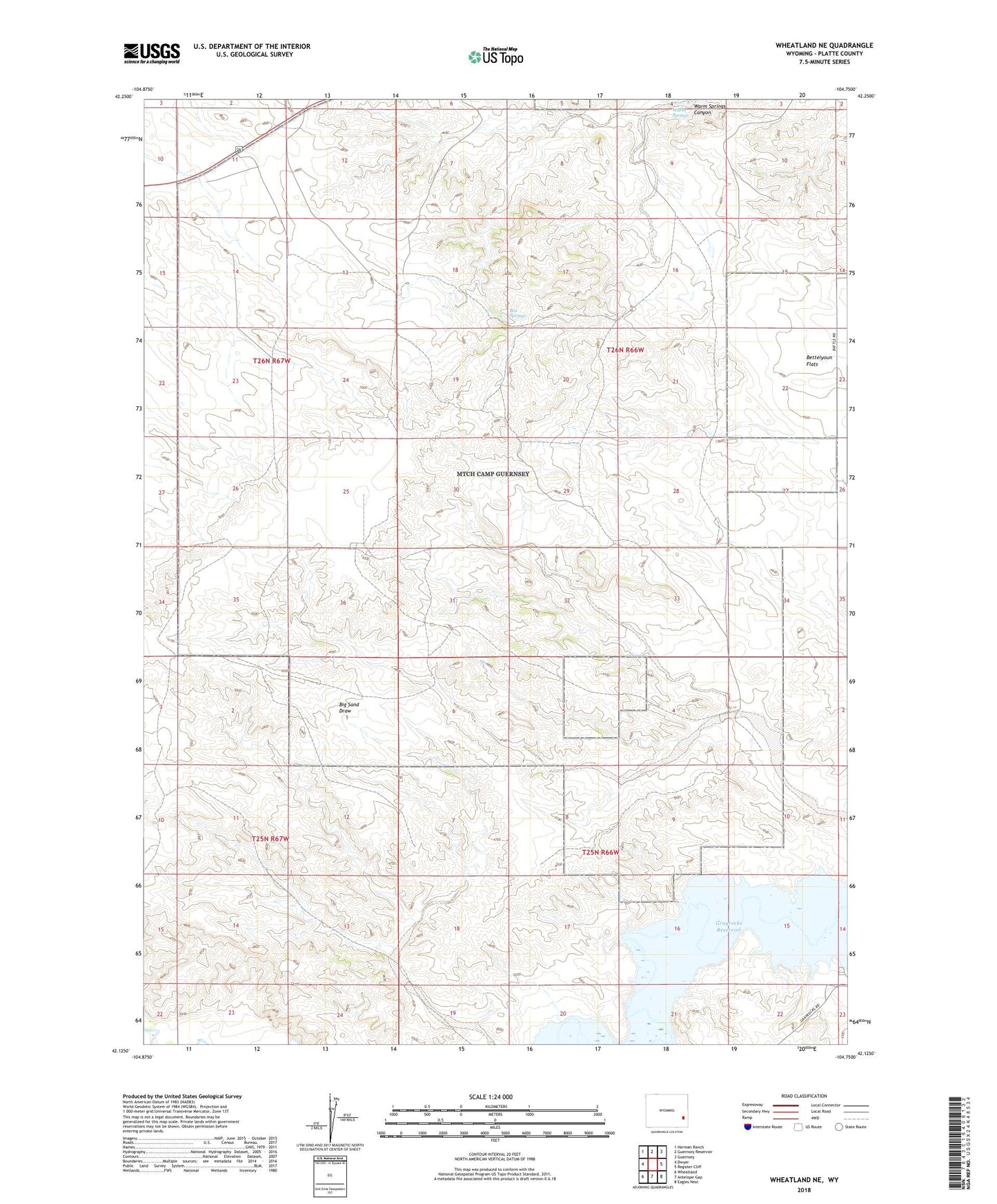
2021 topographic map quadrangle Wheatland NE in the state of Wyoming. Scale: 1:24000. Based on the newly updated USGS 7.5' US Topo map series, this map is in the following counties: Platte. The map contains contour data, water features, and other items you are used to seeing on USGS maps, but also has updated roads and other features. This is the next generation of topographic maps. Printed on high-quality waterproof paper with UV fade-resistant inks.
Quads adjacent to this one:
West: Dwyer
Northwest: Herman Ranch
North: Guernsey Reservoir
Northeast: Guernsey
East: Register Cliff
Southeast: Eagles Nest
South: Antelope Gap
Southwest: Wheatland
This map covers the same area as the classic USGS quad with code o42104b7.
Contains the following named places: Box Springs, Clair Milton Ranch, Don Cundall Ranch, McComb Dam, McComb Reservoir, Milton Ranch, Paul Cundall Ranch, Warm Springs