MyTopo
Hidden Tepee Creek Wyoming US Topo Map
Couldn't load pickup availability
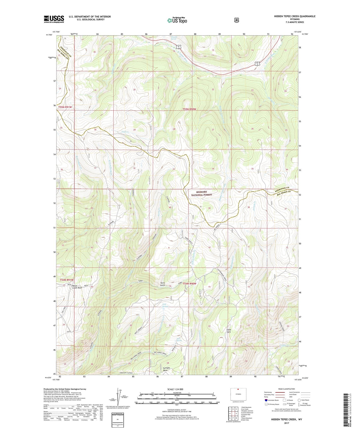
2021 topographic map quadrangle Hidden Tepee Creek in the state of Wyoming. Scale: 1:24000. Based on the newly updated USGS 7.5' US Topo map series, this map is in the following counties: Big Horn, Sheridan. The map contains contour data, water features, and other items you are used to seeing on USGS maps, but also has updated roads and other features. This is the next generation of topographic maps. Printed on high-quality waterproof paper with UV fade-resistant inks.
Quads adjacent to this one:
West: Leavitt Reservoir
Northwest: Bald Mountain
North: Ice Creek
Northeast: Burgess Junction
East: Granite Pass
Southeast: Shell Falls
South: Black Mountain
Southwest: Shell
Contains the following named places: Deer Spring, Dry Horse Trail, East Fork Horse Creek, Elkhorn Trail, Fishhook Creek, Grouse Creek, Hidden Tepee Creek, Horse Creek Cow Camp, Horse Creek Mesa, Long Park, Spring Creek, Sunlight Mesa, Torry Gulch, Trail Creek, Wallrock Creek, West Fork Horse Creek, Whedon Spring, Willey Creek, Wolf Springs