MyTopo
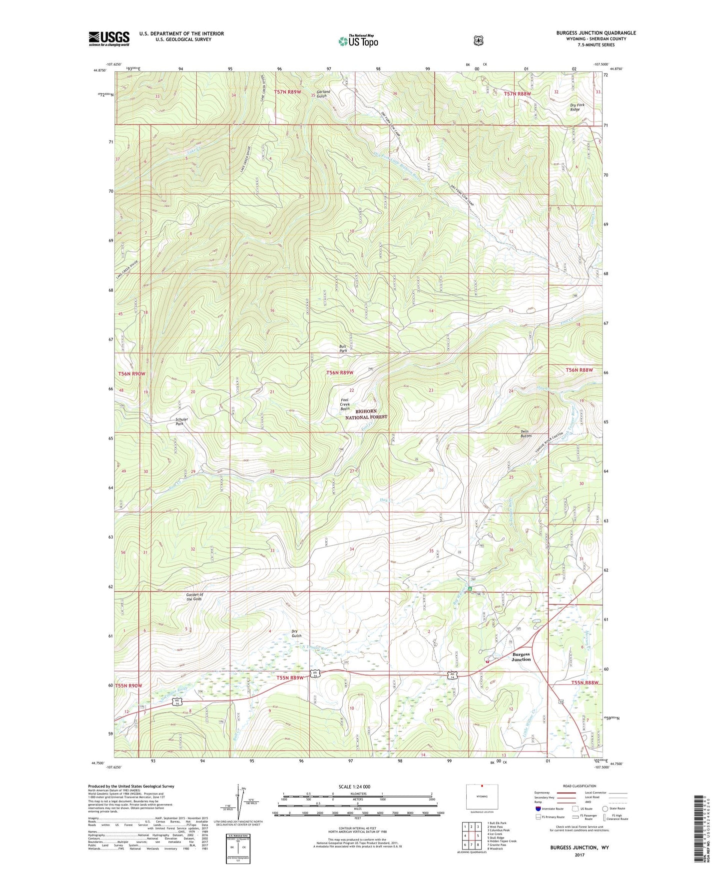
Burgess Junction Wyoming US Topo Map
Couldn't load pickup availability
Also explore the Burgess Junction Forest Service Topo of this same quad for updated USFS data
2021 topographic map quadrangle Burgess Junction in the state of Wyoming. Scale: 1:24000. Based on the newly updated USGS 7.5' US Topo map series, this map is in the following counties: Sheridan. The map contains contour data, water features, and other items you are used to seeing on USGS maps, but also has updated roads and other features. This is the next generation of topographic maps. Printed on high-quality waterproof paper with UV fade-resistant inks.
Quads adjacent to this one:
West: Ice Creek
Northwest: Bull Elk Park
North: West Pass
Northeast: Columbus Peak
East: Skull Ridge
Southeast: Woodrock
South: Granite Pass
Southwest: Hidden Tepee Creek
This map covers the same area as the classic USGS quad with code o44107g5.
Contains the following named places: Bear Lodge, Big Willow Creek, Bull Creek, Bull Park, Burgess Junction, Burgess Junction Rescue, Burgess Picnic Area, Burgess Ranger Station, Dry Fork Ridge, Dry Fork Trail, Dry Gulch, Fool Creek Basin, Garden of the Gods, Garland Gulch, Hay Creek, Hideout Creek, Little Willow Creek, North Tongue River Campground, P K Cow Camp, Schuler Park, Twin Buttes, Twin Buttes Lodge, Wolfe Cow Camp