MyTopo
Horse Peak Wyoming US Topo Map
Couldn't load pickup availability
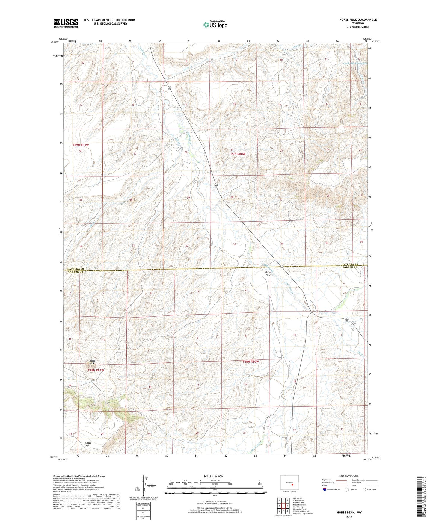
2021 topographic map quadrangle Horse Peak in the state of Wyoming. Scale: 1:24000. Based on the newly updated USGS 7.5' US Topo map series, this map is in the following counties: Natrona, Carbon. The map contains contour data, water features, and other items you are used to seeing on USGS maps, but also has updated roads and other features. This is the next generation of topographic maps. Printed on high-quality waterproof paper with UV fade-resistant inks.
Quads adjacent to this one:
West: Bear Mountain
Northwest: Alcova SE
North: Twin Buttes
Northeast: Sheep Creek
East: Mud Springs
Southeast: Measel Spring Reservoir
South: Wild Irish Reservoir
Southwest: Fourmile Point
This map covers the same area as the classic USGS quad with code o42106d4.
Contains the following named places: Body Ranch, Elk Creek, Froehner Dam, Froehner Reservoir, Horse Peak, Hunt Creek, Kirk Ranch, Lawn Creek, Lone Tree Creek, Sand Draw Number Two Dam, Sand Draw Number Two Reservoir