MyTopo
Twin Buttes Wyoming US Topo Map
Couldn't load pickup availability
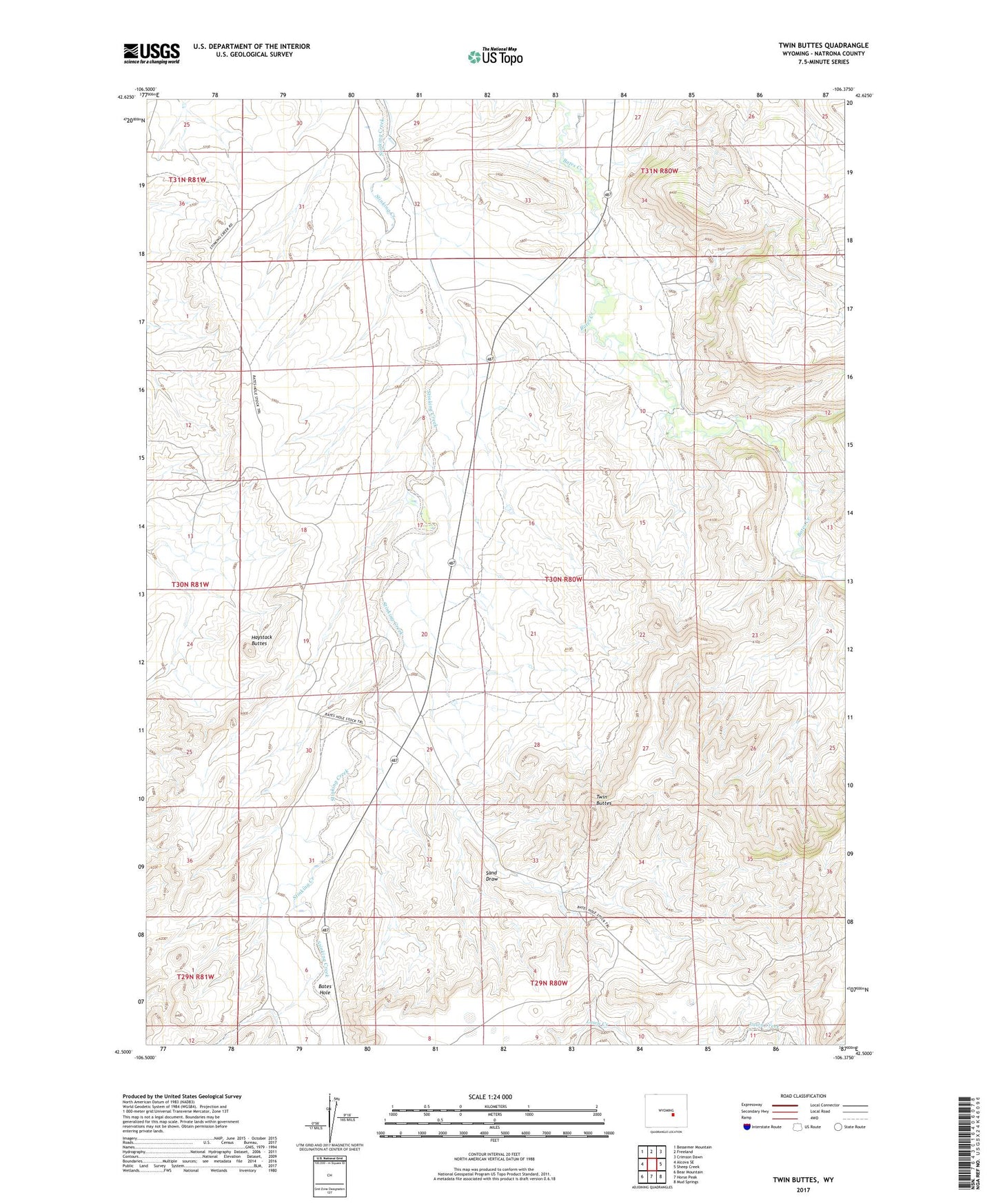
2021 topographic map quadrangle Twin Buttes in the state of Wyoming. Scale: 1:24000. Based on the newly updated USGS 7.5' US Topo map series, this map is in the following counties: Natrona. The map contains contour data, water features, and other items you are used to seeing on USGS maps, but also has updated roads and other features. This is the next generation of topographic maps. Printed on high-quality waterproof paper with UV fade-resistant inks.
Quads adjacent to this one:
West: Alcova SE
Northwest: Bessemer Mountain
North: Freeland
Northeast: Crimson Dawn
East: Sheep Creek
Southeast: Mud Springs
South: Horse Peak
Southwest: Bear Mountain
This map covers the same area as the classic USGS quad with code o42106e4.
Contains the following named places: Bates Hole, Garret Ranch, Hansine Dam, Hansine Reservoir, Haystack Buttes, Hermine Dam, Hermine Reservoir, Posvar Ranch, Sand Draw, Sand Draw Number One Dam, Sand Draw Number One Reservoir, Twin Buttes