MyTopo
Indian Pass Wyoming US Topo Map
Couldn't load pickup availability
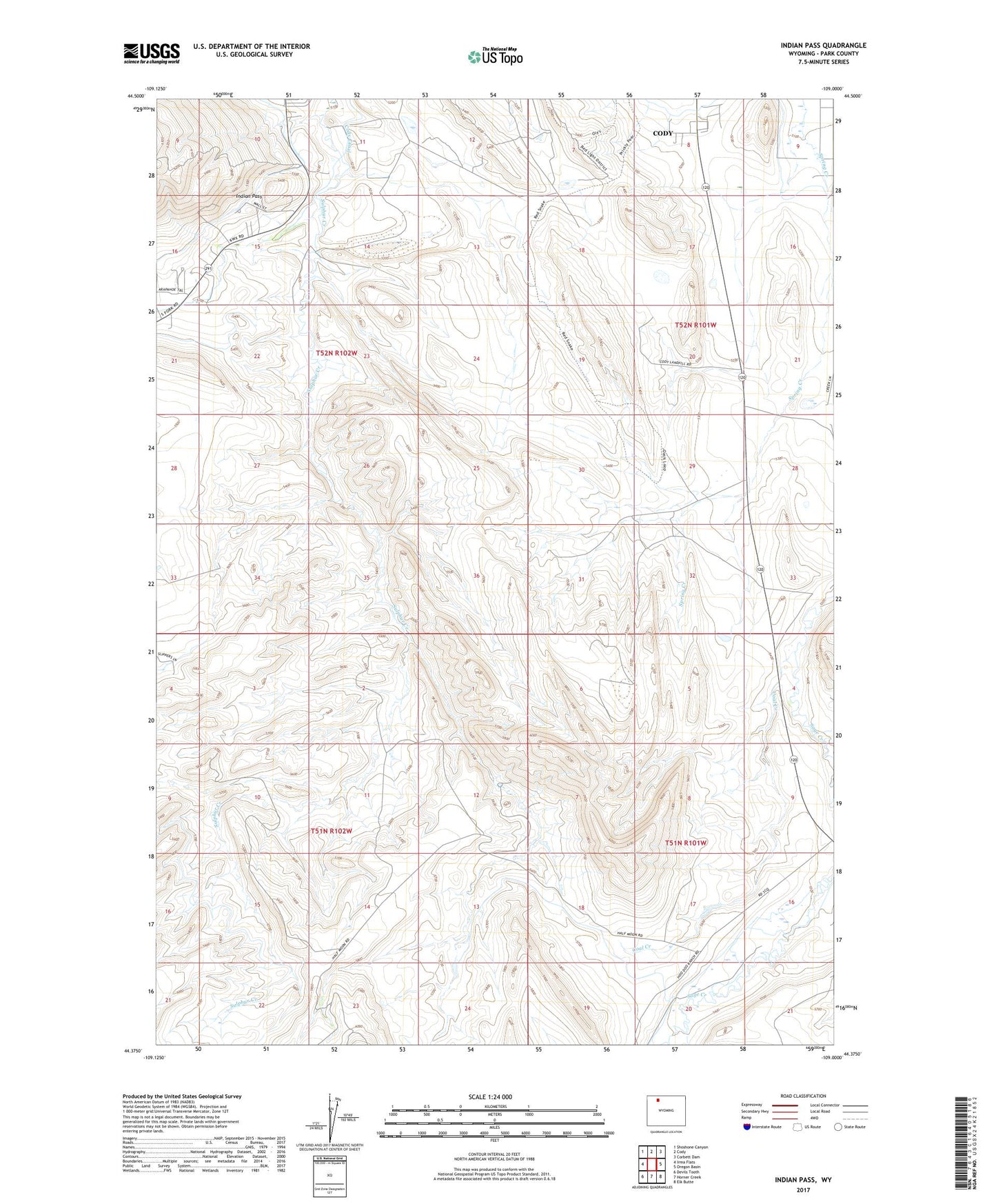
2021 topographic map quadrangle Indian Pass in the state of Wyoming. Scale: 1:24000. Based on the newly updated USGS 7.5' US Topo map series, this map is in the following counties: Park. The map contains contour data, water features, and other items you are used to seeing on USGS maps, but also has updated roads and other features. This is the next generation of topographic maps. Printed on high-quality waterproof paper with UV fade-resistant inks.
Quads adjacent to this one:
West: Irma Flats
Northwest: Shoshone Canyon
North: Cody
Northeast: Corbett Dam
East: Oregon Basin
Southeast: Elk Butte
South: Horner Creek
Southwest: Devils Tooth
This map covers the same area as the classic USGS quad with code o44109d1.
Contains the following named places: Big Horn Gypsum Company Quarry, Cedar Ridge Dam, Cedar Ridge Reservoir, Coal Creek, Indian Pass, Indian Pass Lateral, Pat O'Hara Gypsum Quarry Number One, Spirit Mountain Uranium Company Mine