MyTopo
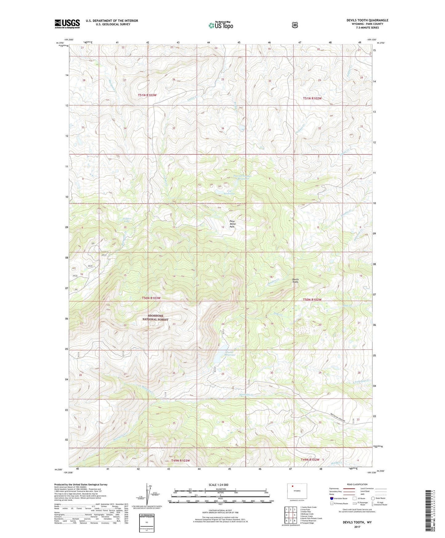
Devils Tooth Wyoming US Topo Map
Couldn't load pickup availability
Also explore the Devils Tooth Forest Service Topo of this same quad for updated USFS data
2023 topographic map quadrangle Devils Tooth in the state of Wyoming. Scale: 1:24000. Based on the newly updated USGS 7.5' US Topo map series, this map is in the following counties: Park. The map contains contour data, water features, and other items you are used to seeing on USGS maps, but also has updated roads and other features. This is the next generation of topographic maps. Printed on high-quality waterproof paper with UV fade-resistant inks.
Quads adjacent to this one:
West: Belknap Creek
Northwest: Castle Rock Creek
North: Irma Flats
Northeast: Indian Pass
East: Horner Creek
Southeast: Tonopah Ridge
South: Thomas Reservoir
Southwest: North Fork Pickett Creek
This map covers the same area as the classic USGS quad with code o44109c2.
Contains the following named places: Bridge Creek, Coe Reservoir, Darrah Dam, Darrah Number 1 Dam, Darrah Number 1 Reservoir, Darrah Number 2 Dam, Darrah Number 2 Reservoir, Darrah Number 3 Reservoir, Devils Tooth, Eagle Lake, Eagle Lake Dam, Foster Number 3 Dam, Foster Number 3 Reservoir, Foster Reservoir, Grabbert Cabin, Hidden Lake, Nina Dam, Nina Reservoir, North Meeteetse Creek, Pete Miller Park, Shoshone Number 1 Dam, Shoshone Number 1 Reservoir, Shoshone Ranch, Sylvan Dam, Sylvan Reservoir