MyTopo
Irvine Wyoming US Topo Map
Couldn't load pickup availability
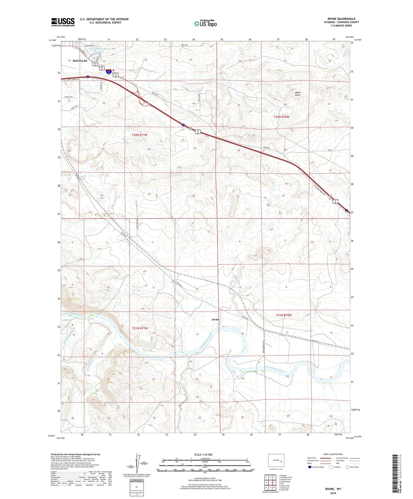
2021 topographic map quadrangle Irvine in the state of Wyoming. Scale: 1:24000. Based on the newly updated USGS 7.5' US Topo map series, this map is in the following counties: Converse. The map contains contour data, water features, and other items you are used to seeing on USGS maps, but also has updated roads and other features. This is the next generation of topographic maps. Printed on high-quality waterproof paper with UV fade-resistant inks.
Quads adjacent to this one:
West: Chalk Buttes
Northwest: Douglas
North: Antelope Creek
Northeast: Simpson Draw
East: Orin
Southeast: Cedar Hill
South: Dilts Ranch
Southwest: Poison Lake
Contains the following named places: Clark Dam, Clark Reservoir, Foster, Irvine, La Bonte Creek, Runden Number 1 Dam, Runden Number 1 Reservoir, Sand Creek, US Forest Service Douglas District - Thunder Basin National Grassland Fire Engine Crew, Wagon Hound Creek, Wyoming Highway Patrol District 2 Division M