MyTopo
Cedar Hill Wyoming US Topo Map
Couldn't load pickup availability
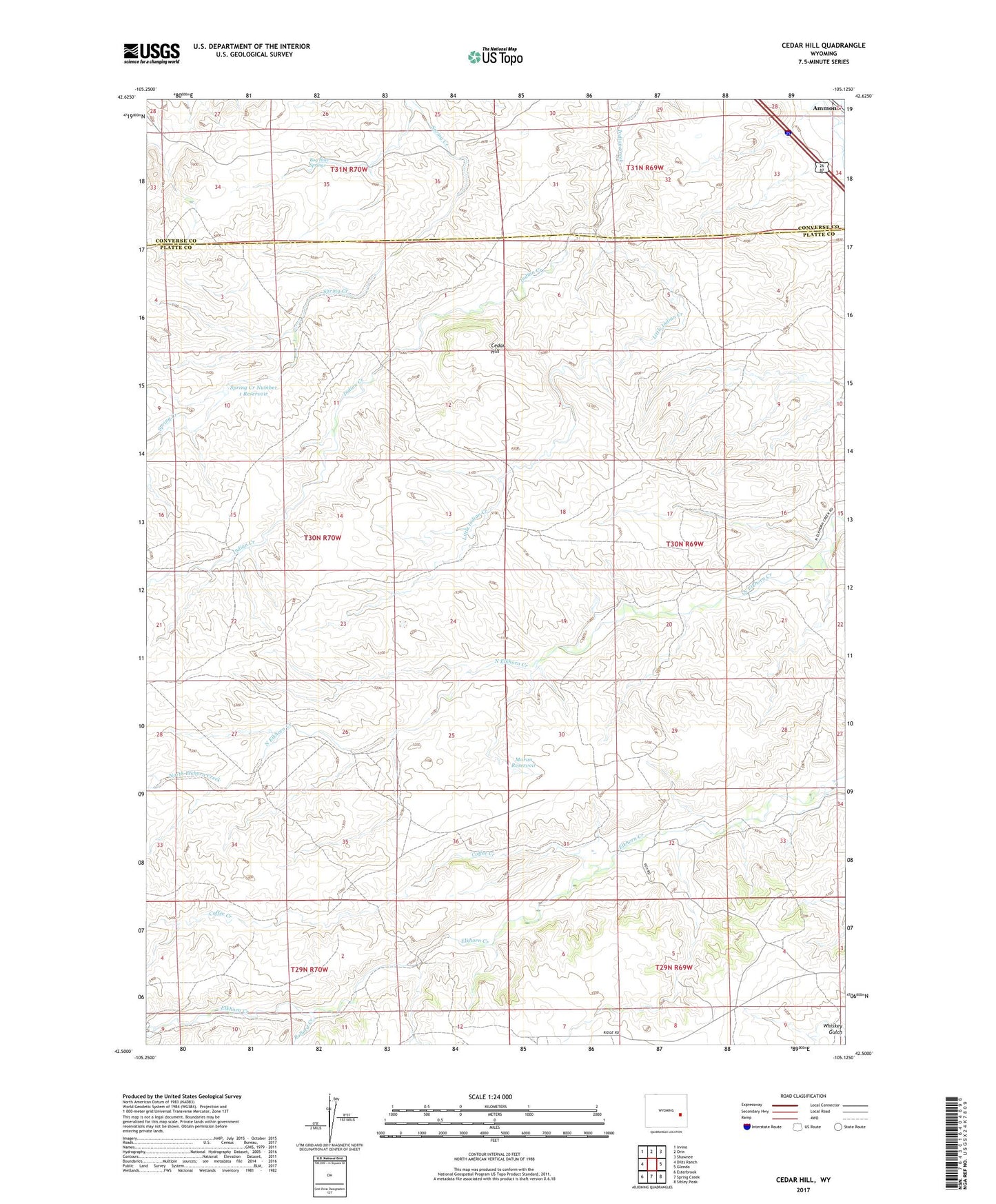
2021 topographic map quadrangle Cedar Hill in the state of Wyoming. Scale: 1:24000. Based on the newly updated USGS 7.5' US Topo map series, this map is in the following counties: Platte, Converse. The map contains contour data, water features, and other items you are used to seeing on USGS maps, but also has updated roads and other features. This is the next generation of topographic maps. Printed on high-quality waterproof paper with UV fade-resistant inks.
Quads adjacent to this one:
West: Dilts Ranch
Northwest: Irvine
North: Orin
Northeast: Shawnee
East: Glendo
Southeast: Sibley Peak
South: Spring Creek
Southwest: Esterbrook
This map covers the same area as the classic USGS quad with code o42105e2.
Contains the following named places: Black Canyon Creek, Bog Hole Springs, Cedar Hill, Cedar Ridge Number 1 Dam, Cedar Ridge Number 1 Reservoir, Coffee Creek, Cundall Ranch, Elkhorn Ranch, Fitzhugh Ranch, Little Indian Creek, Moran Dam, Moran Reservoir, Pollard Creek, Spring Creek Number 1 Dam, Spring Creek Number 1 Reservoir, Stephenson Ranch, Stirrup Ranch