MyTopo
Orin Wyoming US Topo Map
Couldn't load pickup availability
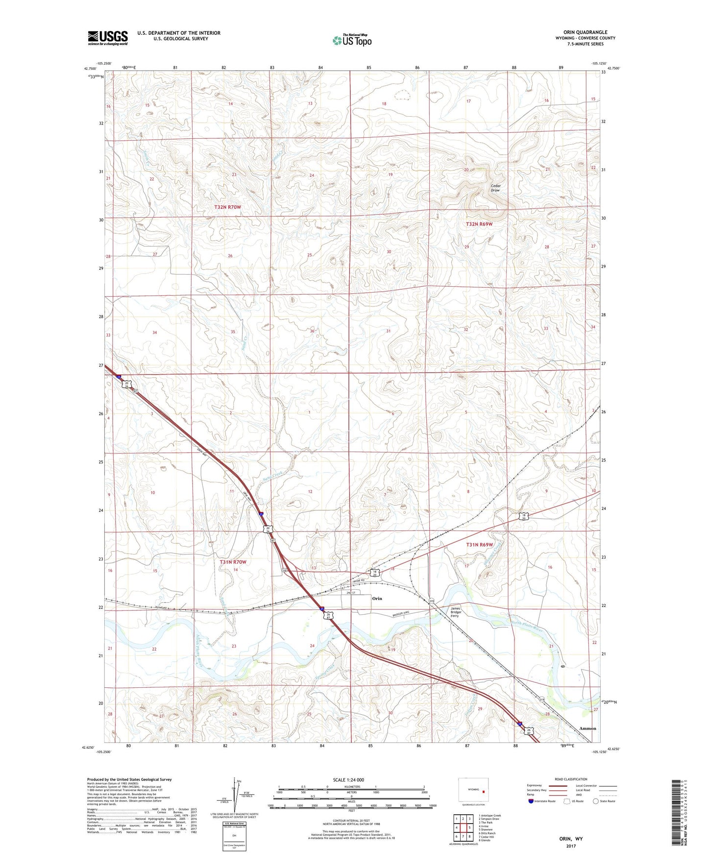
2021 topographic map quadrangle Orin in the state of Wyoming. Scale: 1:24000. Based on the newly updated USGS 7.5' US Topo map series, this map is in the following counties: Converse. The map contains contour data, water features, and other items you are used to seeing on USGS maps, but also has updated roads and other features. This is the next generation of topographic maps. Printed on high-quality waterproof paper with UV fade-resistant inks.
Quads adjacent to this one:
West: Irvine
Northwest: Antelope Creek
North: Simpson Draw
Northeast: The Park
East: Shawnee
Southeast: Glendo
South: Cedar Hill
Southwest: Dilts Ranch
This map covers the same area as the classic USGS quad with code o42105f2.
Contains the following named places: Ammon, Barkdoll Pit Number One, Bennett Ranch, Burke Ranch, CAA Range Station, Cactus Four Claim, Carmin Ranch, Foster Ranch, Howery Ranch, Indian Creek, James Bridger Ferry, McKinley, McKinley Post Office, Nylen and Gillespie Ranch, Oliver Ranch, Orin, Orin Census Designated Place, Orin Junction, Orin Junction Pit, Osgood Ranch, Pollack Ranch, Puckett Ranch, Rogers Ranch, Sand Creek, Sand Creek Mine, Schneider Ranch, Shaw Ranch, Shawnee Creek, Shawnee Creek Area Mine, Smith Creek, Spring Creek, Townsend Ranch