
MyTopo
Kane Wyoming US Topo Map
Couldn't load pickup availability
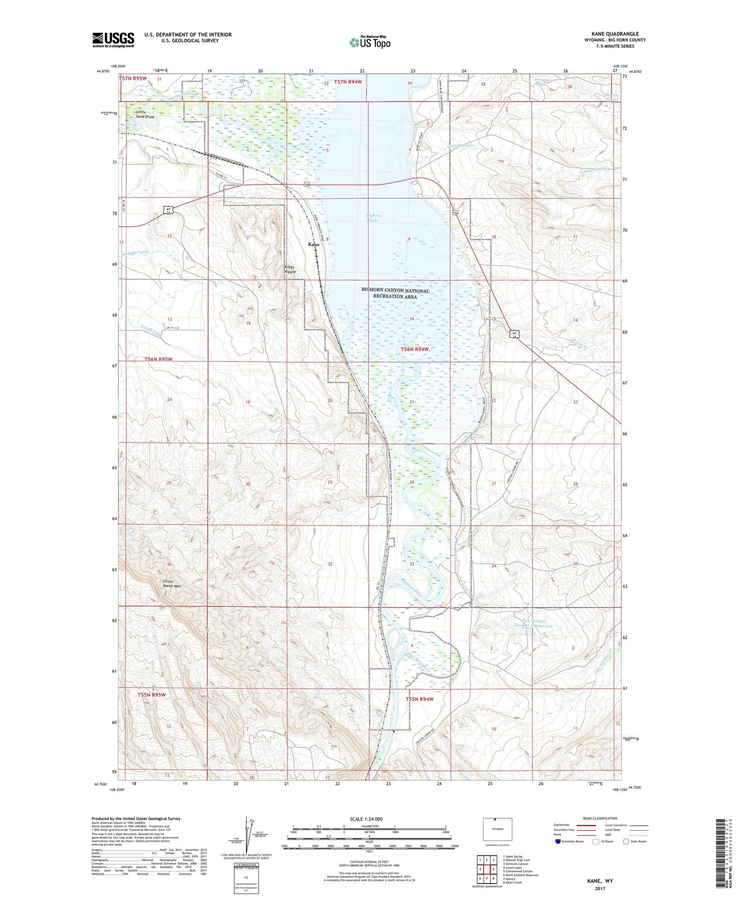
2021 topographic map quadrangle Kane in the state of Wyoming. Scale: 1:24000. Based on the newly updated USGS 7.5' US Topo map series, this map is in the following counties: Big Horn. The map contains contour data, water features, and other items you are used to seeing on USGS maps, but also has updated roads and other features. This is the next generation of topographic maps. Printed on high-quality waterproof paper with UV fade-resistant inks.
Quads adjacent to this one:
West: Lovell Lakes
Northwest: Sykes Spring
North: Natural Trap Cave
Northeast: Simmons Canyon
East: Cottonwood Canyon
Southeast: Alkali Creek
South: Spence
Southwest: North Emblem Reservoir
Contains the following named places: Big Horn River Mine, Bighorn Lake, Bischoff Creek Dam, Bischoff Creek Reservoir, Bureau of Land Management Pit Mine, Cottonwood Creek, Five Springs Creek, Five Springs Number 2 Dam, Five Springs Number 2 Reservoir, Harmon Springs, Kane, Katys Nipple, Little Sand Draw, Little Sheep Mountain Anticline Number Fourteen Mine, Little Sheep Mountain Anticline Number Twenty Mine, Roundup Spring, Shoshone River, Willow Creek, ZIP Code: 82431


