MyTopo
Sykes Spring Wyoming US Topo Map
Couldn't load pickup availability
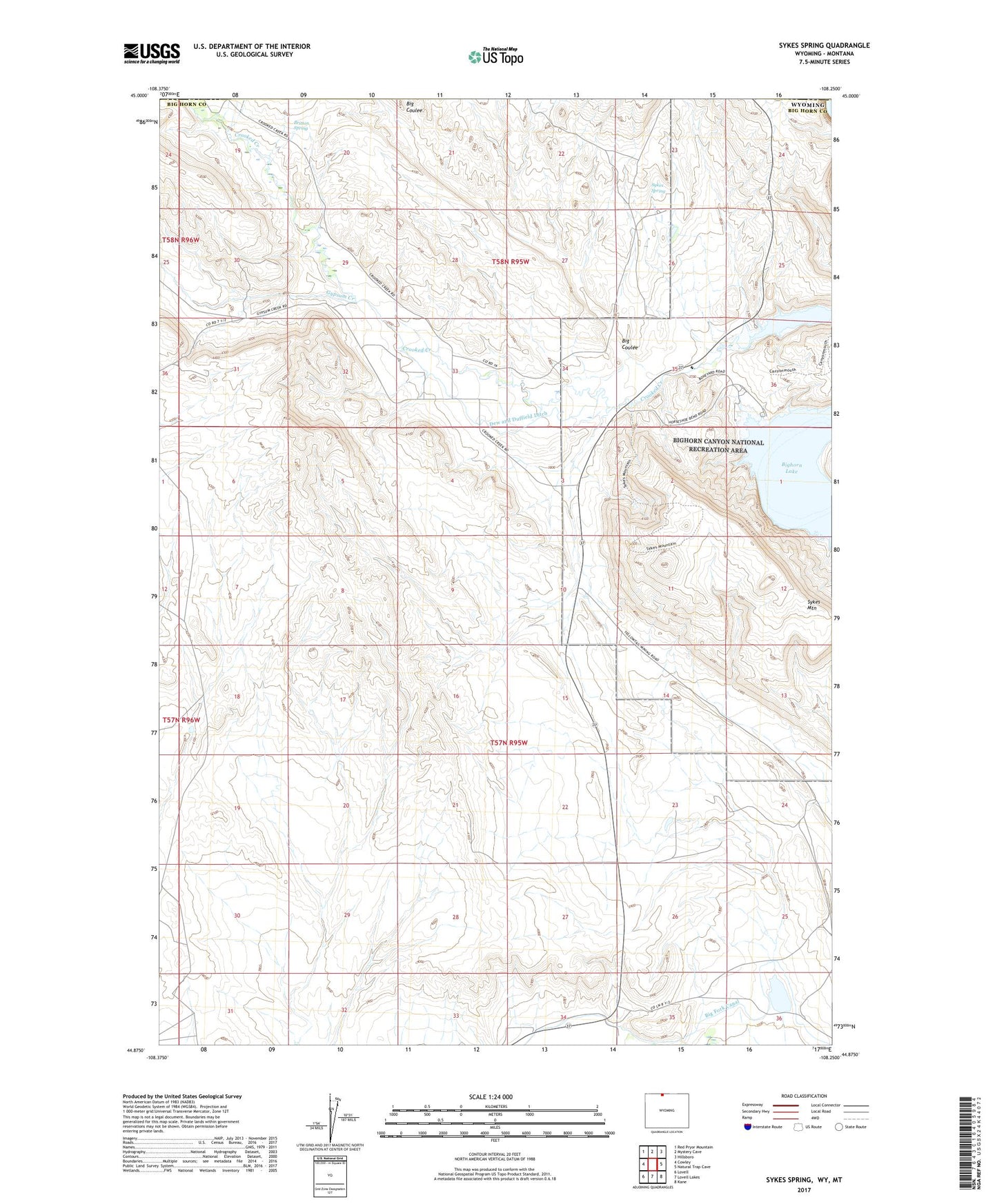
2021 topographic map quadrangle Sykes Spring in the states of Wyoming, Montana. Scale: 1:24000. Based on the newly updated USGS 7.5' US Topo map series, this map is in the following counties: Big Horn, Carbon. The map contains contour data, water features, and other items you are used to seeing on USGS maps, but also has updated roads and other features. This is the next generation of topographic maps. Printed on high-quality waterproof paper with UV fade-resistant inks.
Quads adjacent to this one:
West: Cowley
Northwest: Red Pryor Mountain
North: Mystery Cave
Northeast: Hillsboro
East: Natural Trap Cave
Southeast: Kane
South: Lovell Lakes
Southwest: Lovell
This map covers the same area as the classic USGS quad with code o44108h3.
Contains the following named places: Big Coulee, Big Coulee Mine, Britton Spring, Crooked Creek, Crooked Creek Group Mine, Dew and Duffield Ditch, Gypsum Creek, Gypsum Creek Area Mine, Horseshoe Dam, Horseshoe Reservoir, Lovell Deposit Number One Mine, Lovell Deposit Number Two Mine, Sykes Mountain, Sykes Mountain Mine, Sykes Spring, Three Forks Canyon Area Number Four Mine, Three Forks Canyon Area Number Three Mine