MyTopo
Kisinger Lakes Wyoming US Topo Map
Couldn't load pickup availability
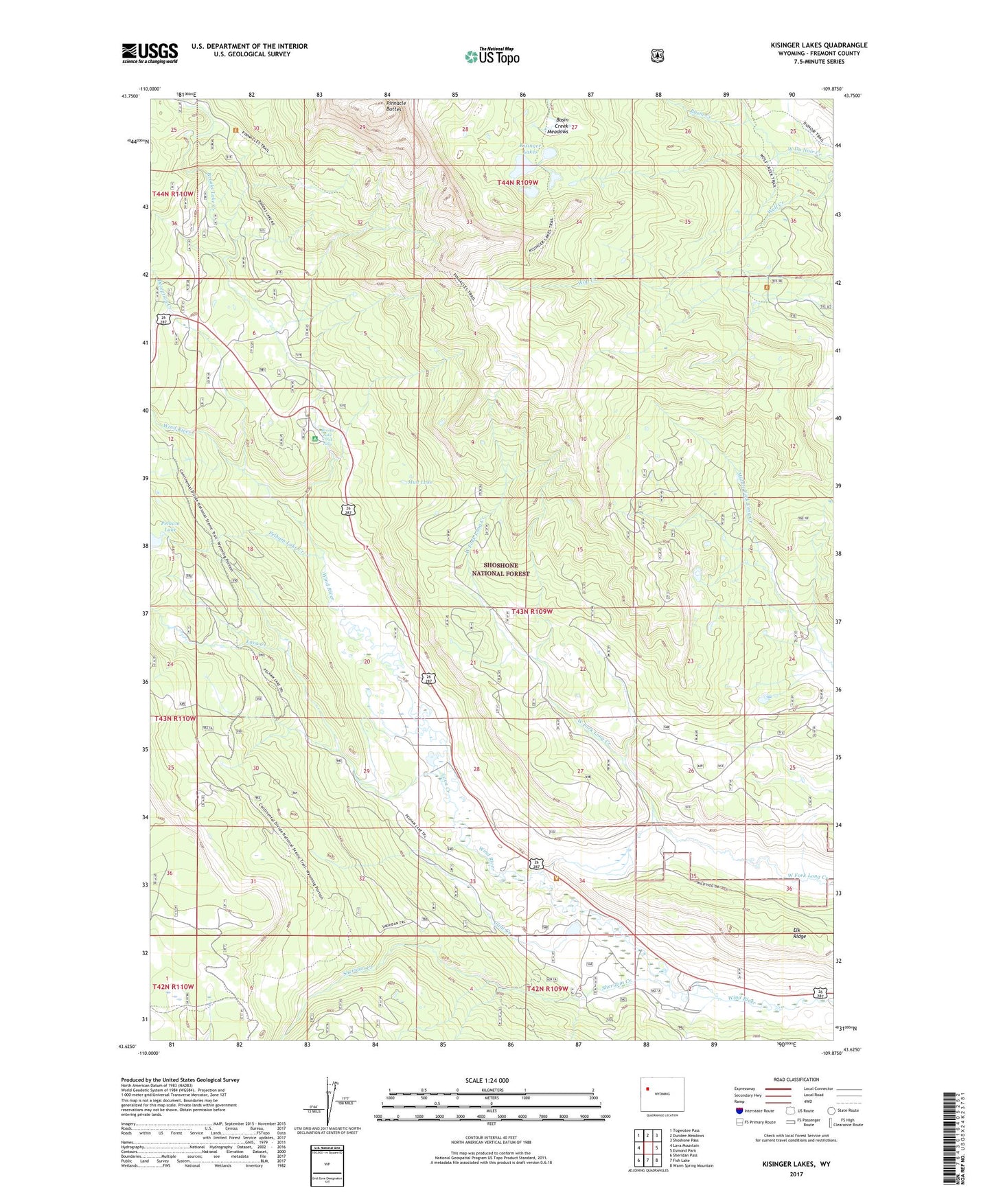
2021 topographic map quadrangle Kisinger Lakes in the state of Wyoming. Scale: 1:24000. Based on the newly updated USGS 7.5' US Topo map series, this map is in the following counties: Fremont. The map contains contour data, water features, and other items you are used to seeing on USGS maps, but also has updated roads and other features. This is the next generation of topographic maps. Printed on high-quality waterproof paper with UV fade-resistant inks.
Quads adjacent to this one:
West: Lava Mountain
Northwest: Togwotee Pass
North: Dundee Meadows
Northeast: Shoshone Pass
East: Esmond Park
Southeast: Warm Spring Mountain
South: Fish Lake
Southwest: Sheridan Pass
Contains the following named places: Basin Creek, Basin Creek Meadows, Brooks Lake Creek, Brooks Lake Creek Falls, Clint Creek, Cross Cow Camp, Deception Creek, Elk Ridge, Falls Campground, Griffith Ranch, Kisinger Lakes, Kisinger Lakes Trail, Lava Creek, Lava Creek Ranch, Mud Lake, Pelham Lake Creek, Pelham Lake Trail, Pinnacle Buttes, Pinnacle Campground, Pinnacle Height Summer Home Group, Pinnacle Trail, Sheridan Creek, Sheridan Creek Guard Station, Sheridan Trail, Tie Hack Historical Monument, Triangle C Pit, Triangle C Ranch, Wind River Ranch