MyTopo
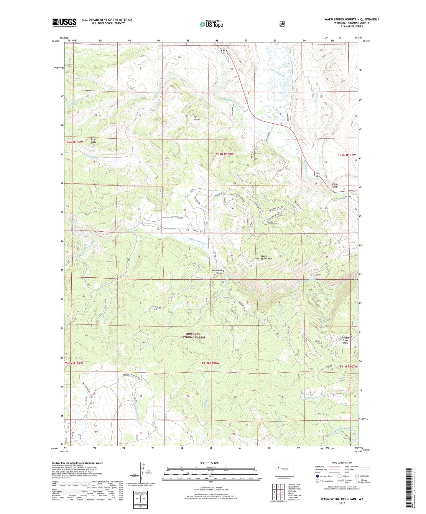
Warm Spring Mountain Wyoming US Topo Map
Couldn't load pickup availability
Also explore the Warm Spring Mountain Forest Service Topo of this same quad for updated USFS data
2021 topographic map quadrangle Warm Spring Mountain in the state of Wyoming. Scale: 1:24000. Based on the newly updated USGS 7.5' US Topo map series, this map is in the following counties: Fremont. The map contains contour data, water features, and other items you are used to seeing on USGS maps, but also has updated roads and other features. This is the next generation of topographic maps. Printed on high-quality waterproof paper with UV fade-resistant inks.
Quads adjacent to this one:
West: Fish Lake
Northwest: Kisinger Lakes
North: Esmond Park
Northeast: Ramshorn Peak
East: Dubois
Southeast: Simpson Lake
South: Union Peak
Southwest: Fish Creek Park
This map covers the same area as the classic USGS quad with code o43109e7.
Contains the following named places: Bear Creek, Bench Creek, Canyon Creek, Cow Camp, Crooked Creek, Du Noir Creek, DuNoir, Geyser Creek Park, Hat Butte, Helt Claims Mine, Johnson Camp, Kitten Creek, Little Warm Springs Creek Mine, North Fork Crooked Creek, Rocker A Ranch, Sand Butte, Sheer Ranch, Smith Sawmill, Snowshoe Creek, South Fork Warm Spring Creek, Stoney Point, Union Pass Trail, Warm Spring Mountain, Warm Spring Mountain Mine, Wildcat Creek