MyTopo
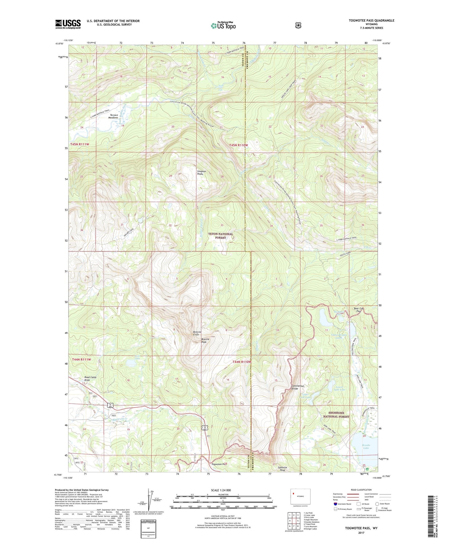
Togwotee Pass Wyoming US Topo Map
Couldn't load pickup availability
Also explore the Togwotee Pass Forest Service Topo of this same quad for updated USFS data
2023 topographic map quadrangle Togwotee Pass in the state of Wyoming. Scale: 1:24000. Based on the newly updated USGS 7.5' US Topo map series, this map is in the following counties: Teton, Fremont. The map contains contour data, water features, and other items you are used to seeing on USGS maps, but also has updated roads and other features. This is the next generation of topographic maps. Printed on high-quality waterproof paper with UV fade-resistant inks.
Quads adjacent to this one:
West: Angle Mountain
Northwest: Joy Peak
North: Crater Lake
Northeast: Ferry Lake
East: Dundee Meadows
Southeast: Kisinger Lakes
South: Lava Mountain
Southwest: Tripod Peak
This map covers the same area as the classic USGS quad with code o43110g1.
Contains the following named places: Bear Cub Pass, Bonneville Creek, Breccia Cliffs, Breccia Peak, Brooks Lake, Brooks Lake Campground, Brooks Lake Creek, Clear Creek, County Line Creek, Cub Creek, Holmes Cave Creek, Lost Lake, Lower Jade Lake, Rainbow Lake, Road Camp Draw, Simpson Peaks, South Fork Falls, Terrace Meadows, Trail Creek, Upper Brooks Lakes, Upper Jade Lake