MyTopo
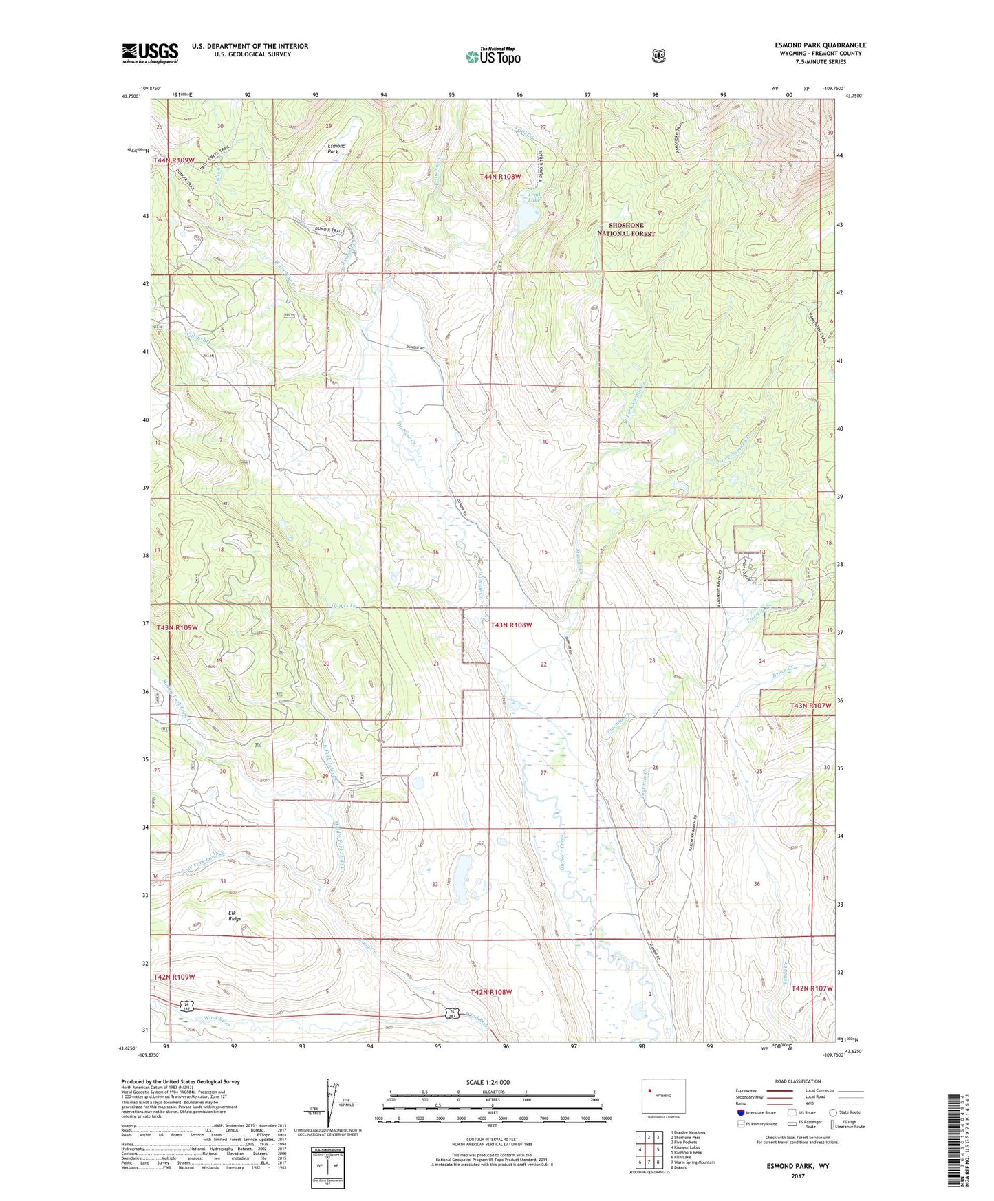
Esmond Park Wyoming US Topo Map
Couldn't load pickup availability
Also explore the Esmond Park Forest Service Topo of this same quad for updated USFS data
2021 topographic map quadrangle Esmond Park in the state of Wyoming. Scale: 1:24000. Based on the newly updated USGS 7.5' US Topo map series, this map is in the following counties: Fremont. The map contains contour data, water features, and other items you are used to seeing on USGS maps, but also has updated roads and other features. This is the next generation of topographic maps. Printed on high-quality waterproof paper with UV fade-resistant inks.
Quads adjacent to this one:
West: Kisinger Lakes
Northwest: Dundee Meadows
North: Shoshone Pass
Northeast: Five Pockets
East: Ramshorn Peak
Southeast: Dubois
South: Warm Spring Mountain
Southwest: Fish Lake
This map covers the same area as the classic USGS quad with code o43109f7.
Contains the following named places: Cross Ranch, Du Noir Trail, East Du Noir Creek, East Fork Long Creek, East Fork Sixmile Creek, Esmond Creek, Esmond Park, Falls Creek, Fivemile Creek, Fourmile Creek, Gap Lake, Glade Ranch, Highland Meadow Ranch, Long Creek, Middle Fork Long Creek, Pickett Ranch, Ramshorn Guest Ranch, Sixmile Creek, Timberline Ranch, Trail Creek, Trail Lake, Trail Lake Control Dam, Trail Lake Dam, West Du Noir Creek, West Fork Long Creek, West Fork Sixmile Creek, Willow Branch, Wolf Creek