MyTopo
Red Gap Wyoming US Topo Map
Couldn't load pickup availability
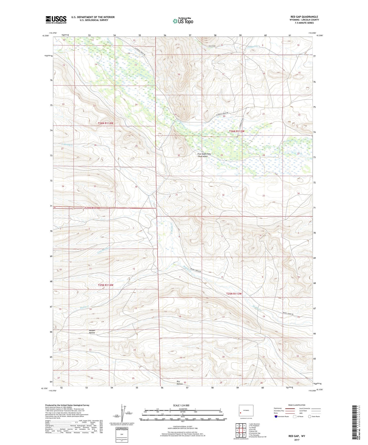
2021 topographic map quadrangle Red Gap in the state of Wyoming. Scale: 1:24000. Based on the newly updated USGS 7.5' US Topo map series, this map is in the following counties: Lincoln. The map contains contour data, water features, and other items you are used to seeing on USGS maps, but also has updated roads and other features. This is the next generation of topographic maps. Printed on high-quality waterproof paper with UV fade-resistant inks.
Quads adjacent to this one:
West: Fort Hill
Northwest: Lake Mountain
North: The Hogsback
Northeast: La Barge
East: Names Hill
Southeast: Fontenelle Reservoir SW
South: The Palisades
Southwest: Fontenelle Gap
This map covers the same area as the classic USGS quad with code o42110b3.
Contains the following named places: Anderson Howard Canal, Burdick Creek, Delaney Creek, Facenelli Ranch, Five Slash Fifty-Three Knoll, Little Muddy Creek, North Muddy Creek, Spring Creek, ZIP Code: 83123