MyTopo
Laramie Wyoming US Topo Map
Couldn't load pickup availability
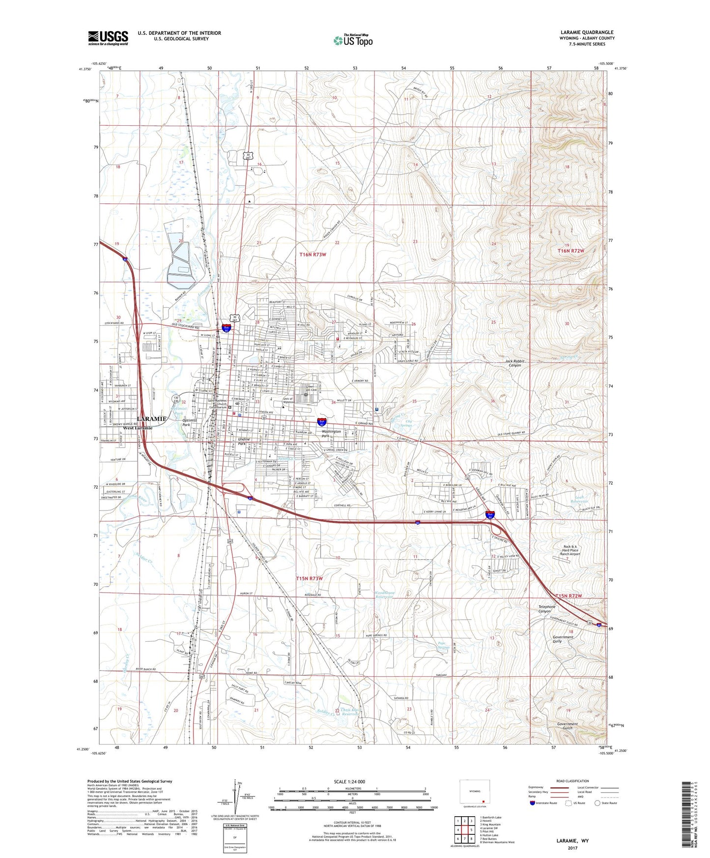
2021 topographic map quadrangle Laramie in the state of Wyoming. Scale: 1:24000. Based on the newly updated USGS 7.5' US Topo map series, this map is in the following counties: Albany. The map contains contour data, water features, and other items you are used to seeing on USGS maps, but also has updated roads and other features. This is the next generation of topographic maps. Printed on high-quality waterproof paper with UV fade-resistant inks.
Quads adjacent to this one:
West: Laramie SW
Northwest: Bamforth Lake
North: Howell
Northeast: King Mountain
East: Pilot Hill
Southeast: Sherman Mountains West
South: Red Buttes
Southwest: Hutton Lake
Contains the following named places: Albany County Sheriff's Office, Beitel School, Campus Mall, Carroll Pit, Chris Klein Dam, Chris Klein Reservoir, City of Laramie, City Springs, Easterling Pit, Evans Airport, Fort Sanders, Government Gulch, Government Gully, Green Hill Cemetery, Harney Creek, Ivinson Memorial Hospital, Jack Rabbit Canyon, Justin Pit, Kay Pit, KLDI-AM (Laramie), KOWB-AM (Laramie), Laramie, Laramie Country Club, Laramie Fire Department Station 1, Laramie Fire Department Station 2, Laramie Plaza, Laramie Police Department, Laramie Post Office, Leah Reservoir, Lincoln School, Nellie Iles School, Odd Fellows Shopping Center, Optimist Park, Pope Springs, Rock & A Hard Place Ranch Airport, Saint Lawrence School, Saint Mathews Church Columbarium, Slade School, Soldier Creek, Spring Creek, Stanton School, Sterling Limestone Quarry, Telephone Canyon, Undine Park, University of Wyoming, Washington Park, Washington School, West Laramie, Whiting School, Woodhouse Dam, Woodhouse Reservoir, Wyoming Highway Patrol Station District 1 Division J, ZIP Code: 82073