MyTopo
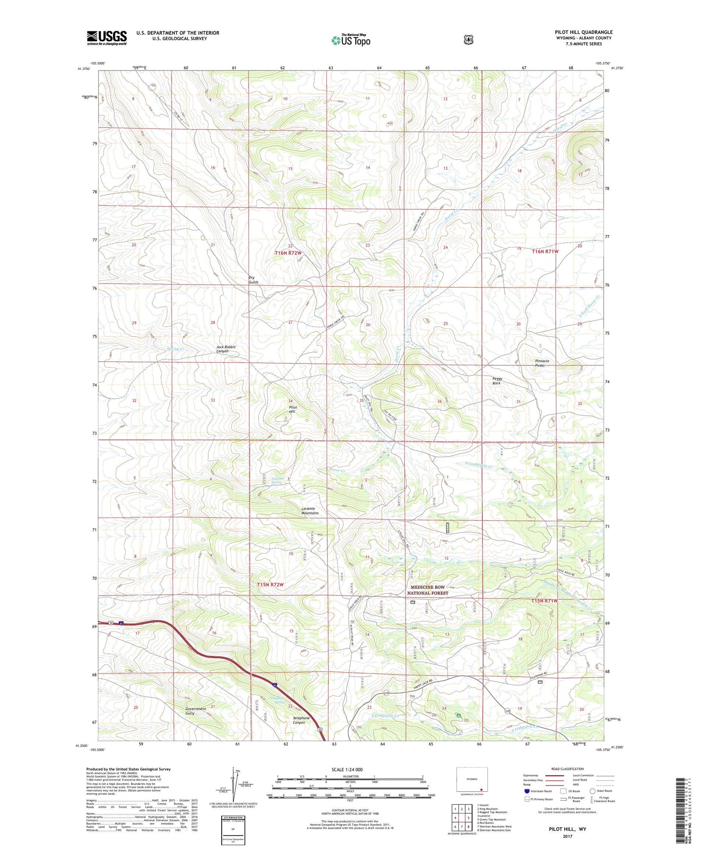
Pilot Hill Wyoming US Topo Map
Couldn't load pickup availability
Also explore the Pilot Hill Forest Service Topo of this same quad for updated USFS data
2021 topographic map quadrangle Pilot Hill in the state of Wyoming. Scale: 1:24000. Based on the newly updated USGS 7.5' US Topo map series, this map is in the following counties: Albany. The map contains contour data, water features, and other items you are used to seeing on USGS maps, but also has updated roads and other features. This is the next generation of topographic maps. Printed on high-quality waterproof paper with UV fade-resistant inks.
Quads adjacent to this one:
West: Laramie
Northwest: Howell
North: King Mountain
Northeast: Ragged Top Mountain
East: Green Top Mountain
Southeast: Sherman Mountains East
South: Sherman Mountains West
Southwest: Red Buttes
This map covers the same area as the classic USGS quad with code o41105c4.
Contains the following named places: Happy Jack Winter Sports Area, KCGY-FM (Laramie), KIMX-FM (Laramie), KRQU-FM (Laramie), KUWR-FM (Laramie), Laycock Spring, Peggy Rock, Pilot Hill, Pinnacle Peaks, Pole Creek Campground, Ridge Camp Trail, Telephone Spring, Telephone Spring Picnic Area, Tie City Campground, Warren Livestock Summer Camp, Yellow Pine Campground