MyTopo
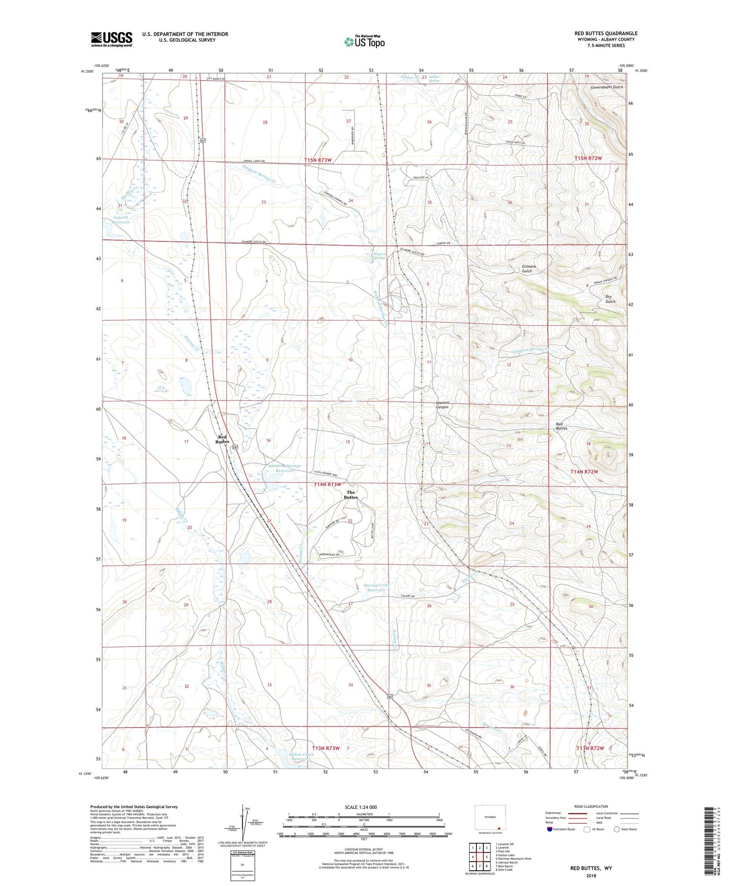
Red Buttes Wyoming US Topo Map
Couldn't load pickup availability
2021 topographic map quadrangle Red Buttes in the state of Wyoming. Scale: 1:24000. Based on the newly updated USGS 7.5' US Topo map series, this map is in the following counties: Albany. The map contains contour data, water features, and other items you are used to seeing on USGS maps, but also has updated roads and other features. This is the next generation of topographic maps. Printed on high-quality waterproof paper with UV fade-resistant inks.
Quads adjacent to this one:
West: Hutton Lake
Northwest: Laramie SW
North: Laramie
Northeast: Pilot Hill
East: Sherman Mountains West
Southeast: Dale Creek
South: Best Ranch
Southwest: Johnson Ranch
This map covers the same area as the classic USGS quad with code o41105b5.
Contains the following named places: Colores, Double X Ranch, Dry Gulch, Gilmore Gulch, Goforth Reservoir, Harney Creek Dam, Harney Creek Reservoir, Harney Creek Valley Mine, Hundred Springs Dam, Leazenby Lake, Lembcke Ranch, Monolith Goforth Ranch, Monolith Hunziker Ranch, Monolith Ranch, Monolith Well Number 1, Monolith Well Number 3, Monolith Well Number 5, Monolith Well Number 7, Piper Ranch, Red Buttes, Sawmill Canyon, Simpson Springs, Simpson Springs Creek, Soldier Spring, Spring Creek, The Buttes, The Buttes Census Designated Place, Willow Creek Ranch, Willow Creek Reservoir, Wright Ranch