MyTopo
Lombard Buttes Wyoming US Topo Map
Couldn't load pickup availability
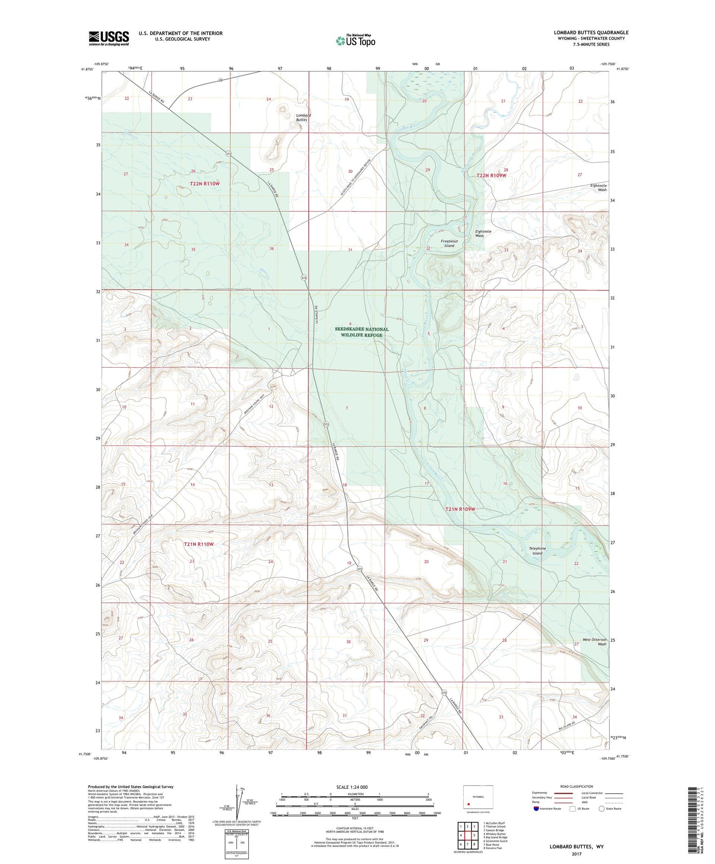
2021 topographic map quadrangle Lombard Buttes in the state of Wyoming. Scale: 1:24000. Based on the newly updated USGS 7.5' US Topo map series, this map is in the following counties: Sweetwater. The map contains contour data, water features, and other items you are used to seeing on USGS maps, but also has updated roads and other features. This is the next generation of topographic maps. Printed on high-quality waterproof paper with UV fade-resistant inks.
Quads adjacent to this one:
West: Whiskey Buttes
Northwest: McCullen Bluff
North: Thoman School
Northeast: Gasson Bridge
East: Big Island Bridge
Southeast: Stevens Flat
South: Blue Point
Southwest: Sevenmile Gulch
This map covers the same area as the classic USGS quad with code o41109g7.
Contains the following named places: Big Sandy River, Dunkle Ranch, Eightmile Wash, Freezeout Island, Johnson Ranch, Lombard Buttes, Otterson Ditch, Rood Ditch, Seedskadee National Wildlife Refuge, Shute Creek, Telephone Island