MyTopo
Sevenmile Gulch Wyoming US Topo Map
Couldn't load pickup availability
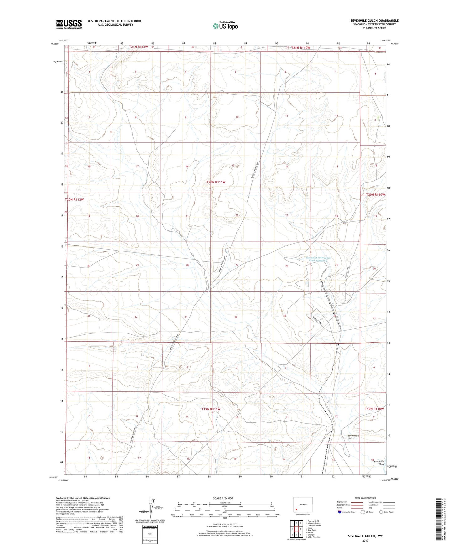
2021 topographic map quadrangle Sevenmile Gulch in the state of Wyoming. Scale: 1:24000. Based on the newly updated USGS 7.5' US Topo map series, this map is in the following counties: Sweetwater. The map contains contour data, water features, and other items you are used to seeing on USGS maps, but also has updated roads and other features. This is the next generation of topographic maps. Printed on high-quality waterproof paper with UV fade-resistant inks.
Quads adjacent to this one:
West: Moxa
Northwest: Fontenelle SE
North: Whiskey Buttes
Northeast: Lombard Buttes
East: Blue Point
Southeast: Little America
South: Granger
Southwest: Verne
This map covers the same area as the classic USGS quad with code o41109f8.
Contains the following named places: Sevenmile Gulch, Sevenmile Wash, Texasgulf Emergency Pond Number 2, Texasgulf Emergency Pond Number 2 Dam, Texasgulf Soda Ash Project Mine, Yellow Point Fork Sevenmile Gulch