MyTopo
Lusk Wyoming US Topo Map
Couldn't load pickup availability
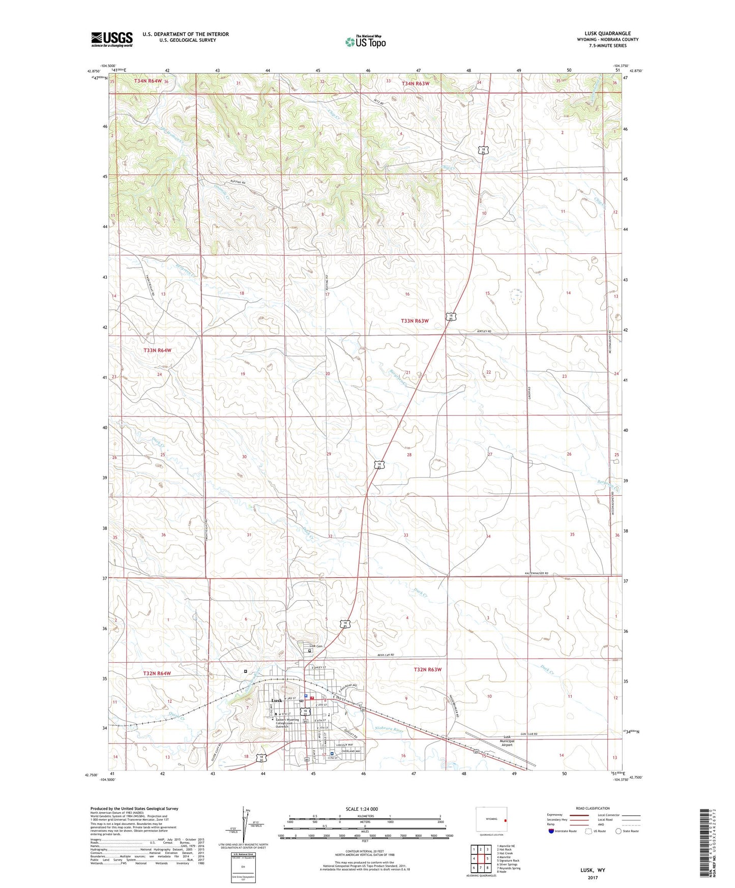
2021 topographic map quadrangle Lusk in the state of Wyoming. Scale: 1:24000. Based on the newly updated USGS 7.5' US Topo map series, this map is in the following counties: Niobrara. The map contains contour data, water features, and other items you are used to seeing on USGS maps, but also has updated roads and other features. This is the next generation of topographic maps. Printed on high-quality waterproof paper with UV fade-resistant inks.
Quads adjacent to this one:
West: Manville
Northwest: Manville NE
North: Hat Rock
Northeast: Hat Creek
East: Signature Rock
Southeast: Node
South: Reynolds Spring
Southwest: Silver Springs
This map covers the same area as the classic USGS quad with code o42104g4.
Contains the following named places: George Gibson Field, Lusk, Lusk - Niobrara Emergency Medical Services, Lusk Cemetery, Lusk Middle School, Lusk Municipal Airport, Lusk Police Department, Lusk Post Office, Lusk School, Lusk Volunteer Fire Department, Niobrara County High School, Niobrara County Nursing Home, Niobrara County Sheriff's Office, Niobrara Health and Life Center, Onemile Creek, Quinn Creek, Town of Lusk, Wyoming Women's Center