MyTopo
Mammoth Wyoming US Topo Map
Couldn't load pickup availability
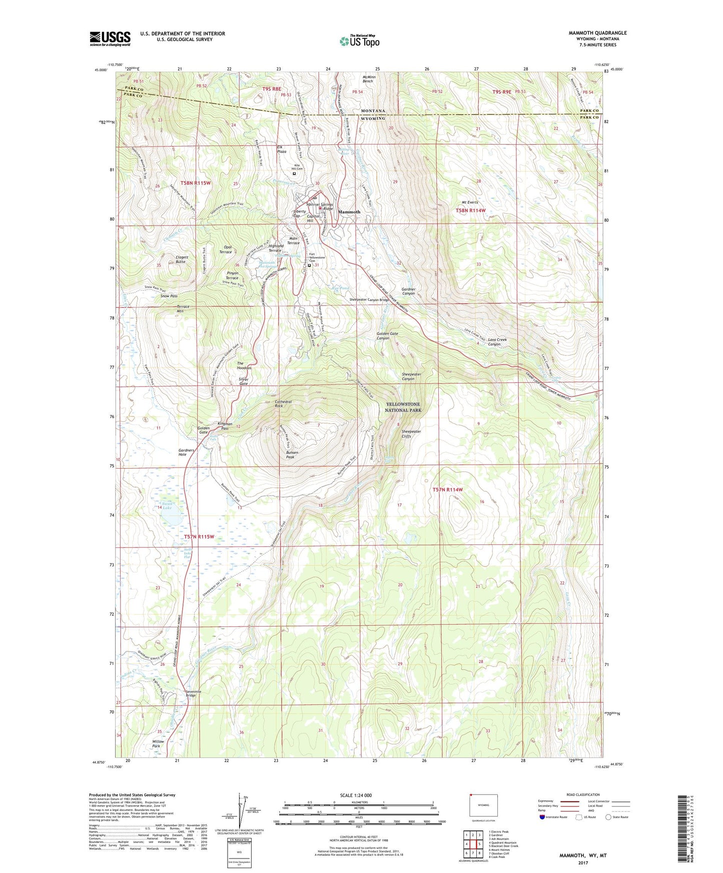
2021 topographic map quadrangle Mammoth in the states of Wyoming, Montana. Scale: 1:24000. Based on the newly updated USGS 7.5' US Topo map series, this map is in the following counties: Park. The map contains contour data, water features, and other items you are used to seeing on USGS maps, but also has updated roads and other features. This is the next generation of topographic maps. Printed on high-quality waterproof paper with UV fade-resistant inks.
Quads adjacent to this one:
West: Quadrant Mountain
Northwest: Electric Peak
North: Gardiner
Northeast: Ash Mountain
East: Blacktail Deer Creek
Southeast: Cook Peak
South: Obsidian Cliff
Southwest: Mount Holmes
Contains the following named places: Beaver Lakes Loop Trail, Beaver Ponds, Boiling River, Bunsen Peak, Capitol Hill, Cathedral Rock, Clagett Butte, Clematis Creek, Elk Plaza, Fort Yellowstone Army Cemetery, Glen Creek, Golden Gate, Golden Gate Canyon, Highland Spring, Highland Terrace, Indian Creek, Indian Creek Campground, Kingman Pass, Lava Creek, Lava Creek Campgrounds, Lava Creek Canyon, Liberty Cap, Lupine Creek, Main Terrace, Mammoth, Mammoth Census Designated Place, Mammoth Civilian Cemetery, Mammoth Hot Springs, Mount Everts, Obsidian Creek, Opal Terrace, Osprey Falls, Panther Creek, Pinyon Terrace, Primrose Creek, Rustic Falls, Rye Pond, Sepulcher Loop Trail, Sevenmile Bridge, Sheepeater Canyon, Sheepeater Canyon Bridge, Sheepeater Cliffs, Silver Gate, Snow Pass, Squirrel Springs Ridge, Swan Lake, Swan Lake Flat, Terrace Mountain, The Hoodoos, Undine Falls, Yellowstone National Park Fire Department - Mammoth Station, Yellowstone National Park Post Office