MyTopo
Manderson Wyoming US Topo Map
Couldn't load pickup availability
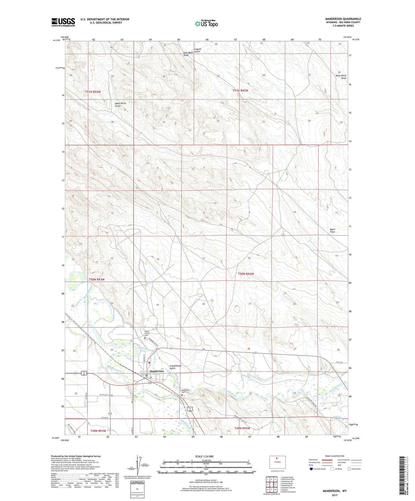
2021 topographic map quadrangle Manderson in the state of Wyoming. Scale: 1:24000. Based on the newly updated USGS 7.5' US Topo map series, this map is in the following counties: Big Horn. The map contains contour data, water features, and other items you are used to seeing on USGS maps, but also has updated roads and other features. This is the next generation of topographic maps. Printed on high-quality waterproof paper with UV fade-resistant inks.
Quads adjacent to this one:
West: Orchard Bench
Northwest: Greybull South
North: Wild Horse Flats
Northeast: Manderson NE
East: Manderson SE
Southeast: McDermotts Butte
South: Rairden
Southwest: Schuster Flats NE
This map covers the same area as the classic USGS quad with code o44107c8.
Contains the following named places: Ainsworth Pumping Station, Big Horn Fire District 3, Cloud Peak Middle School, Dead Horse Gulch, Dobie Creek, Flagstaff Mine, Harmony Ditch, Manderson, Manderson Cemetery, Manderson Elementary School, Manderson Oil Field, Manderson Post Office, Nowood River, Rogers and Gapin Mine, Sand Creek, Schoolhouse Gulch, Smith Family Cemetery, Torchlight Dome Oil Field, Town of Manderson, Valley Ranch Mine