MyTopo
McDermotts Butte Wyoming US Topo Map
Couldn't load pickup availability
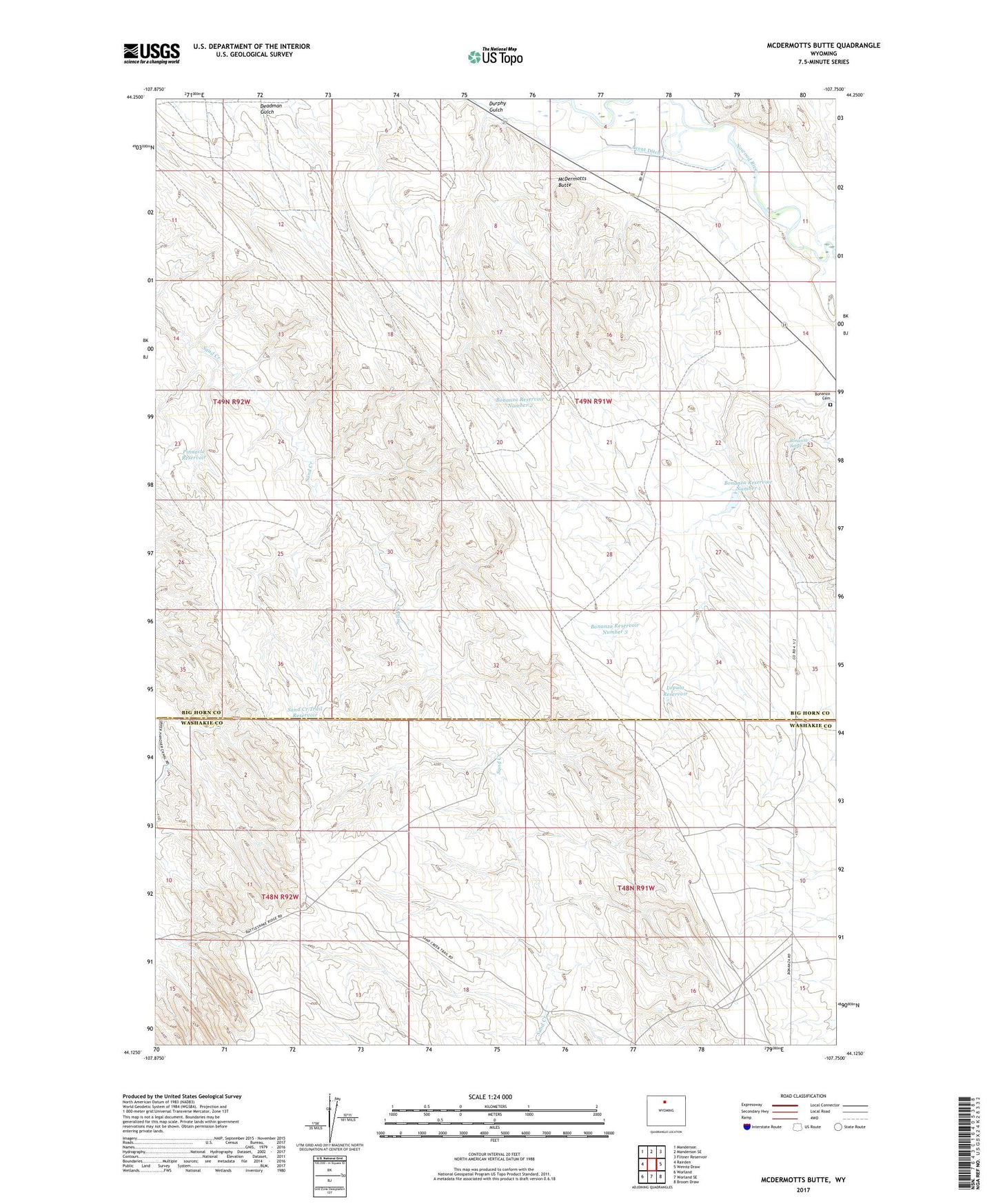
2021 topographic map quadrangle McDermotts Butte in the state of Wyoming. Scale: 1:24000. Based on the newly updated USGS 7.5' US Topo map series, this map is in the following counties: Big Horn, Washakie. The map contains contour data, water features, and other items you are used to seeing on USGS maps, but also has updated roads and other features. This is the next generation of topographic maps. Printed on high-quality waterproof paper with UV fade-resistant inks.
Quads adjacent to this one:
West: Rairden
Northwest: Manderson
North: Manderson SE
Northeast: Flitner Reservoir
East: Weintz Draw
Southeast: Broom Draw
South: Worland SE
Southwest: Worland
Contains the following named places: Bonanza Cemetery, Bonanza Pumping Station, Bonanza Reservoir Number 1, Bonanza Reservoir Number 1 Dam, Bonanza Reservoir Number 2, Bonanza Reservoir Number 3, Bonanza Seeps, Deadman Gulch, Durphy Gulch, Lapula Reservoir, McDermotts Butte, Pinnacle Reservoir, Sand Creek Trail Reservoir, Sand Creek Well, ZIP Code: 82432