MyTopo
Worland Wyoming US Topo Map
Couldn't load pickup availability
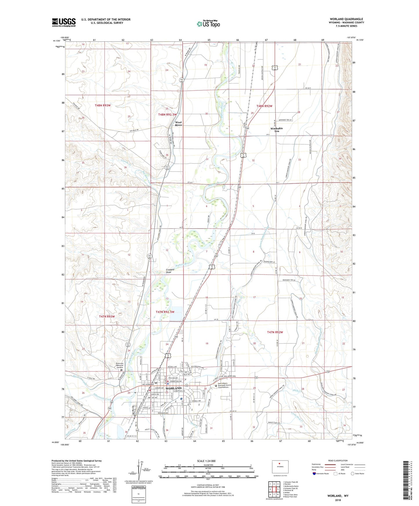
2021 topographic map quadrangle Worland in the state of Wyoming. Scale: 1:24000. Based on the newly updated USGS 7.5' US Topo map series, this map is in the following counties: Washakie. The map contains contour data, water features, and other items you are used to seeing on USGS maps, but also has updated roads and other features. This is the next generation of topographic maps. Printed on high-quality waterproof paper with UV fade-resistant inks.
Quads adjacent to this one:
West: Schuster Flats SE
Northwest: Schuster Flats NE
North: Rairden
Northeast: McDermotts Butte
East: Worland SE
Southeast: Banjo Flats East
South: Banjo Flats West
Southwest: Neiber
This map covers the same area as the classic USGS quad with code o44107a8.
Contains the following named places: Bluff Canal, City of Worland, Community Care of America at Worland, Crooked Draw, East Side Elementary School, East Side School, Evans Shopping Center, Fifteenmile Creek, Gee Mine, Highland Hanover Canal, KWOR-AM (Worland), Leithead Dam, Leithead Reservoir, Little Slick Creek, Lower Hanover Canal, McCormac Pit Number One Mine, North Side School, Riverview Memorial Gardens, Sage Creek, Saint Alban's Episcopal Church Columbarium, Saint Mary Magdalen School, Sanders Park, Slick Creek, South Side Elementary School, South Side School, Tenmile Creek, Washakie County Emergency Medical Services, Washakie Medical Center, Washakie Ten, Washakie Ten Census Designated Place, West River, West River Census Designated Place, West Side Elementary School, West Side School, Worland, Worland High School, Worland Middle School, Worland Police Department, Worland Post Office, Worland Volunteer Fire Department, Wyoming Highway Patrol District 5 Division G