MyTopo
McKinnon Wyoming US Topo Map
Couldn't load pickup availability
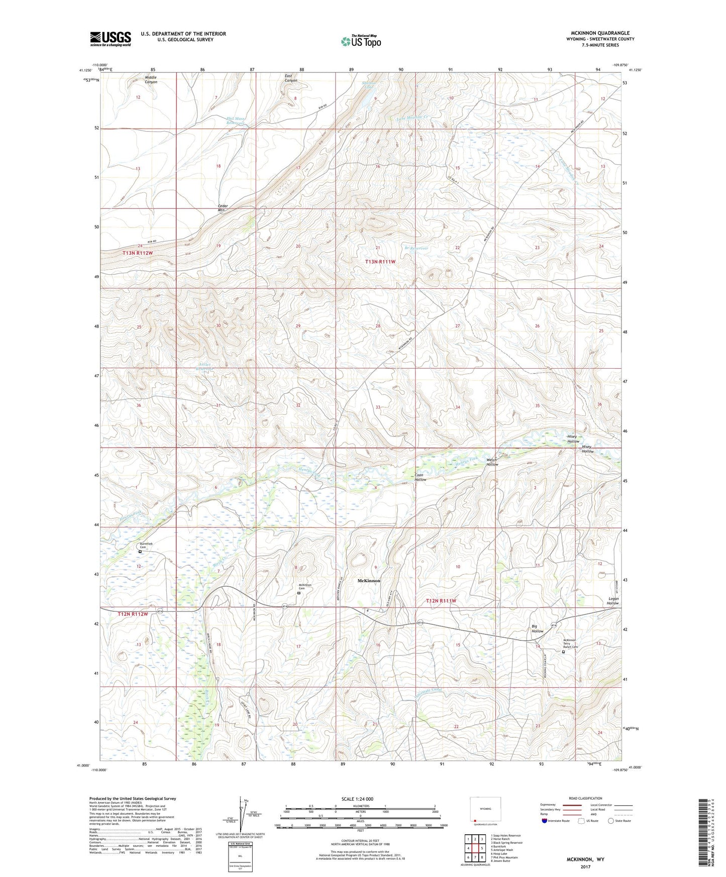
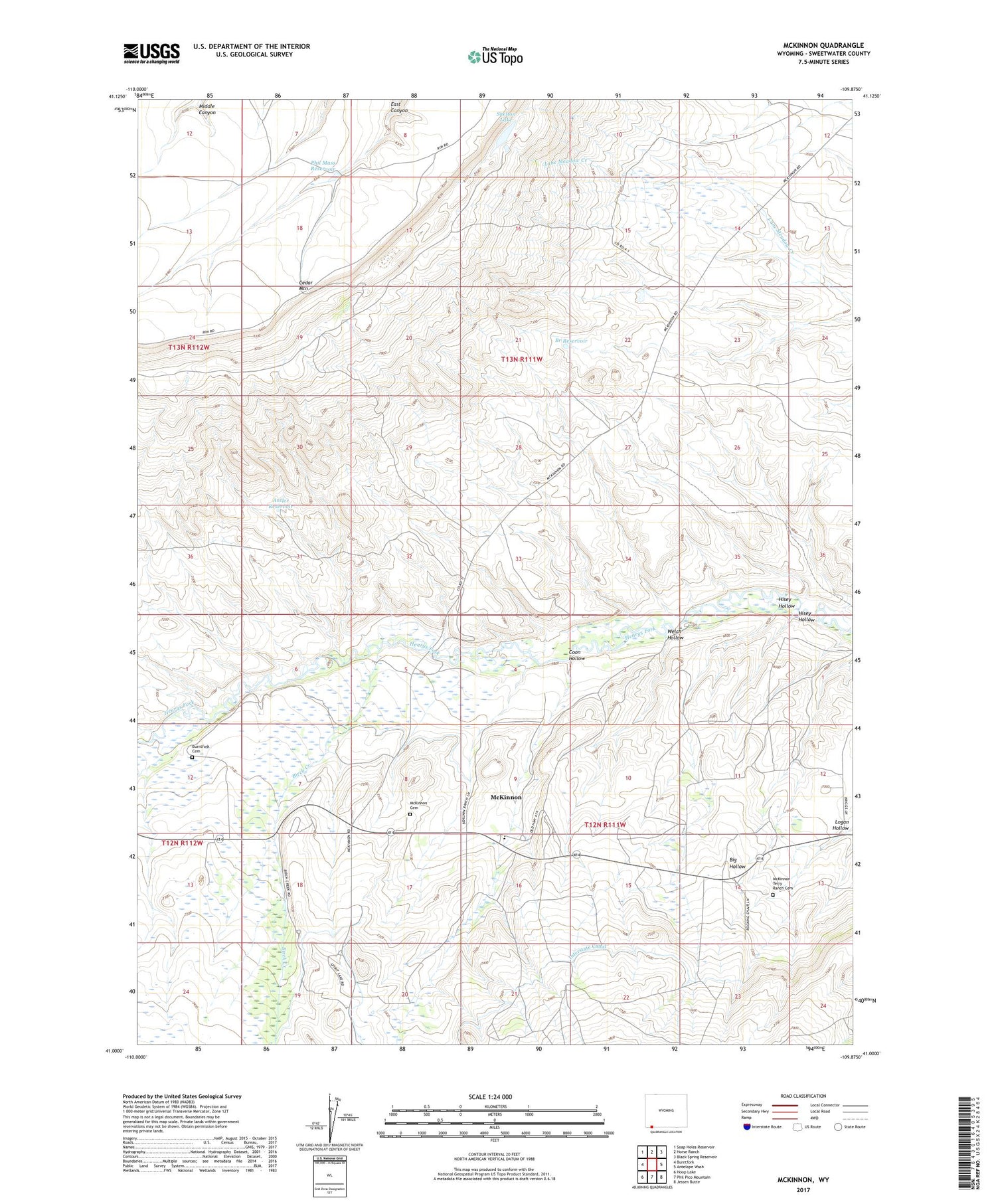
2021 topographic map quadrangle McKinnon in the state of Wyoming. Scale: 1:24000. Based on the newly updated USGS 7.5' US Topo map series, this map is in the following counties: Sweetwater. The map contains contour data, water features, and other items you are used to seeing on USGS maps, but also has updated roads and other features. This is the next generation of topographic maps. Printed on high-quality waterproof paper with UV fade-resistant inks.
Quads adjacent to this one:
West: Burntfork
Northwest: Soap Holes Reservoir
North: Horse Ranch
Northeast: Black Spring Reservoir
East: Antelope Wash
Southeast: Jessen Butte
South: Phil Pico Mountain
Southwest: Hoop Lake
Contains the following named places: Antler Reservoir, Birch Creek, Branch Reservoir, Burntfork Cemetery, Coon Hollow, Hisey Hollow, Indian Mine, Interstate Canal, McKinnon, McKinnon Cemetery, McKinnon Census Designated Place, McKinnon Middle School, Phil Mass Reservoir, Rendezvous, Shelton Lake, Terry Ranch Cemetery, Welch Hollow, ZIP Code: 82938