MyTopo
Burntfork Wyoming US Topo Map
Couldn't load pickup availability
Also explore the Burntfork Forest Service Topo of this same quad for updated USFS data
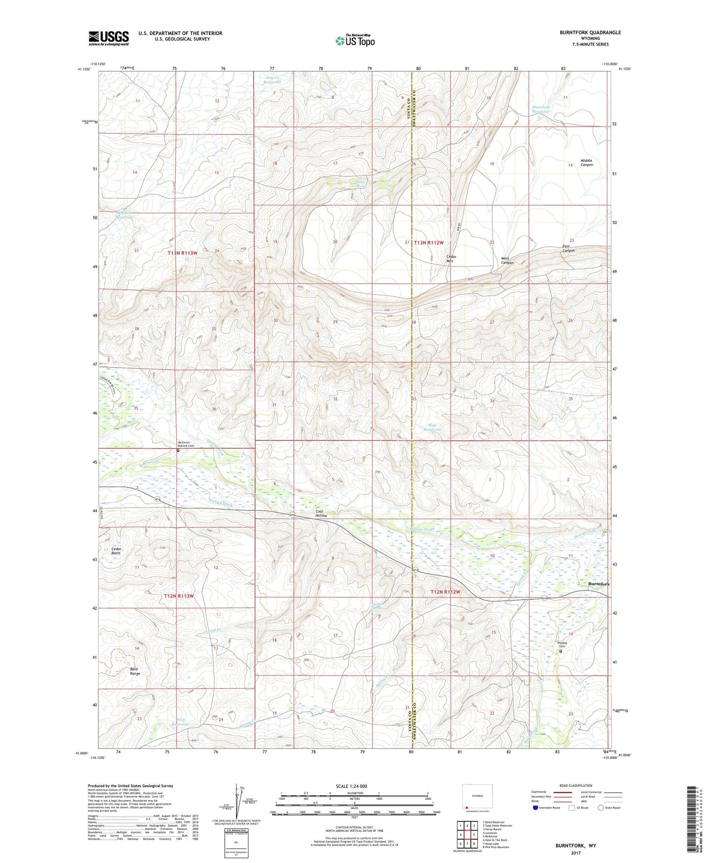
2021 topographic map quadrangle Burntfork in the state of Wyoming. Scale: 1:24000. Based on the newly updated USGS 7.5' US Topo map series, this map is in the following counties: Uinta, Sweetwater. The map contains contour data, water features, and other items you are used to seeing on USGS maps, but also has updated roads and other features. This is the next generation of topographic maps. Printed on high-quality waterproof paper with UV fade-resistant inks.
Quads adjacent to this one:
West: Lonetree
Northwest: Reed Reservoir
North: Soap Holes Reservoir
Northeast: Horse Ranch
East: McKinnon
Southeast: Phil Pico Mountain
South: Hoop Lake
Southwest: Hole In The Rock
This map covers the same area as the classic USGS quad with code o41110a1.
Contains the following named places: Beaver Creek, Behunin Reservoir, Burnt Fork, Burntfork, Cedar Basin, Cedar Basin Ditch, Cedar Mountain, Coal Hollow, Dry Creek Reservoir, Hussman Reservoir, Lamb Creek, McGinnis - Bullock Cemetery, Nielsen Ditch, Nielsen Spring, Slide Reservoir, Spring Creek, Webb Spring, Well Reservoir, Widdop Cemetery