MyTopo
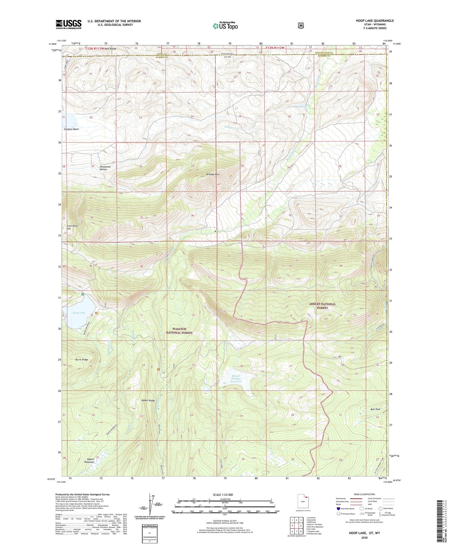
Hoop Lake Utah US Topo Map
Couldn't load pickup availability
Also explore the Hoop Lake Forest Service Topo of this same quad for updated USFS data
2023 topographic map quadrangle Hoop Lake in the states of Utah, Wyoming. Scale: 1:24000. Based on the newly updated USGS 7.5' US Topo map series, this map is in the following counties: Summit, Uinta, Sweetwater, Daggett. The map contains contour data, water features, and other items you are used to seeing on USGS maps, but also has updated roads and other features. This is the next generation of topographic maps. Printed on high-quality waterproof paper with UV fade-resistant inks.
Quads adjacent to this one:
West: Hole In The Rock
Northwest: Lonetree
North: Burntfork
Northeast: McKinnon
East: Phil Pico Mountain
Southeast: Whiterocks Lake
South: Chepeta Lake
Southwest: Fox Lake
Contains the following named places: Bald Range, Beaver Meadow Reservoir, Bull Park, Gregory Basin, Hoop Lake, Hoop Lake Campground, Indian Creek, Indian Spring, Kabell Creek, Kabell Meadows, Lost Creek, Lost Creek Park, Telephone Hollow, Thompson Creek, Widdop Mountain