MyTopo
McPherson Springs Wyoming US Topo Map
Couldn't load pickup availability
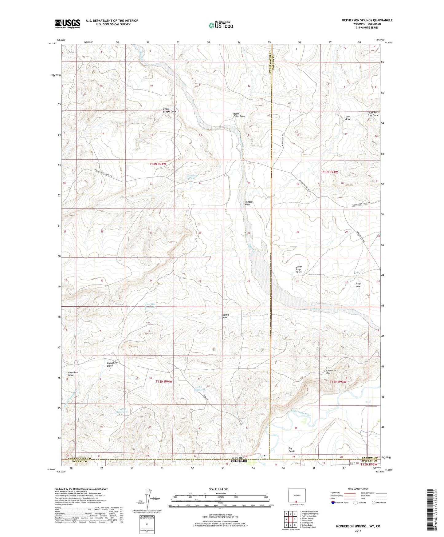
2021 topographic map quadrangle McPherson Springs in the state of Wyoming. Scale: 1:24000. Based on the newly updated USGS 7.5' US Topo map series, this map is in the following counties: Sweetwater, Carbon, Moffat. The map contains contour data, water features, and other items you are used to seeing on USGS maps, but also has updated roads and other features. This is the next generation of topographic maps. Printed on high-quality waterproof paper with UV fade-resistant inks.
Quads adjacent to this one:
West: Rotten Springs
Northwest: Powder Mountain NE
North: Dripping Rock Spring
Northeast: Flat Top Mountain
East: Poison Basin
Southeast: Thornburgh Gulch
South: Bighole Butte
Southwest: The Nipple NE
This map covers the same area as the classic USGS quad with code o41107a8.
Contains the following named places: Anthill Reservoir, Cedar Breaks Draw, Cherokee Basin, Cherokee Draw, Cherokee Rim, Clay Flat Reservoir, Colloid Draw, Dry Gulch, Dry Reservoir, Hangout Wash, Hartt Cabin Draw, Lower Soap Holes, McPherson Springs, Soap Holes, South Fork Tree Draw, Tree Draw