MyTopo
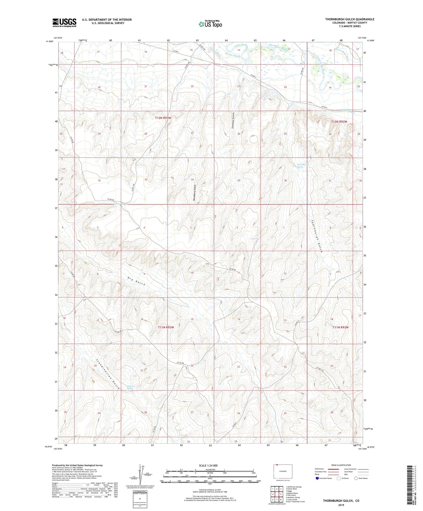
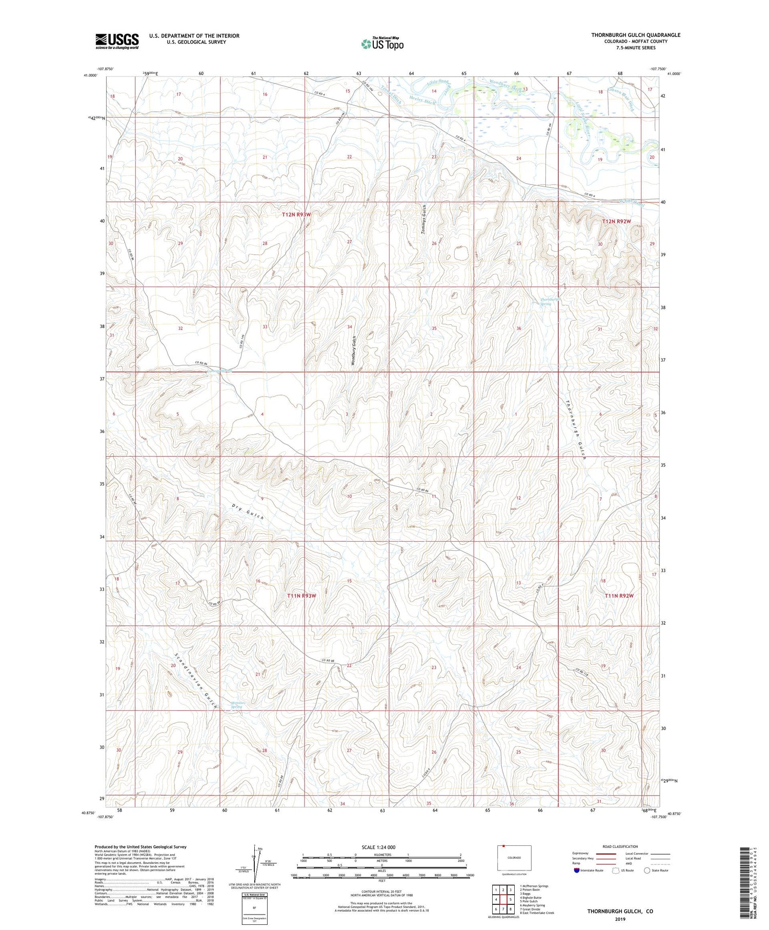
Thornburgh Gulch Colorado US Topo Map
Couldn't load pickup availability
2022 topographic map quadrangle Thornburgh Gulch in the state of Colorado. Scale: 1:24000. Based on the newly updated USGS 7.5' US Topo map series, this map is in the following counties: Moffat. The map contains contour data, water features, and other items you are used to seeing on USGS maps, but also has updated roads and other features. This is the next generation of topographic maps. Printed on high-quality waterproof paper with UV fade-resistant inks.
Quads adjacent to this one:
West: Bighole Butte
Northwest: McPherson Springs
North: Poison Basin
Northeast: Baggs
East: Pole Gulch
Southeast: East Timberlake Creek
South: Great Divide
Southwest: Mayberry Spring
This map covers the same area as the classic USGS quad with code o40107h7.
Contains the following named places: Conway Spring, Dry Gulch Mine, Gibson Blair Ditch, Monasco Spring, Thornburgh Gulch, Thornburgh Spring, Tommys Gulch, Trowel Ditch, Woodbury Gulch