MyTopo
Meriden Wyoming US Topo Map
Couldn't load pickup availability
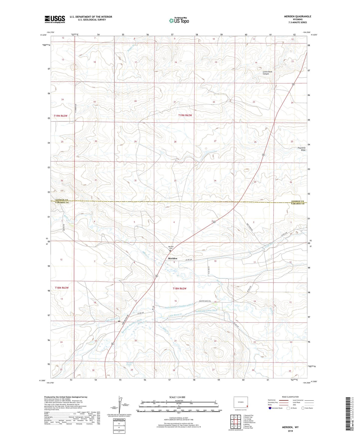
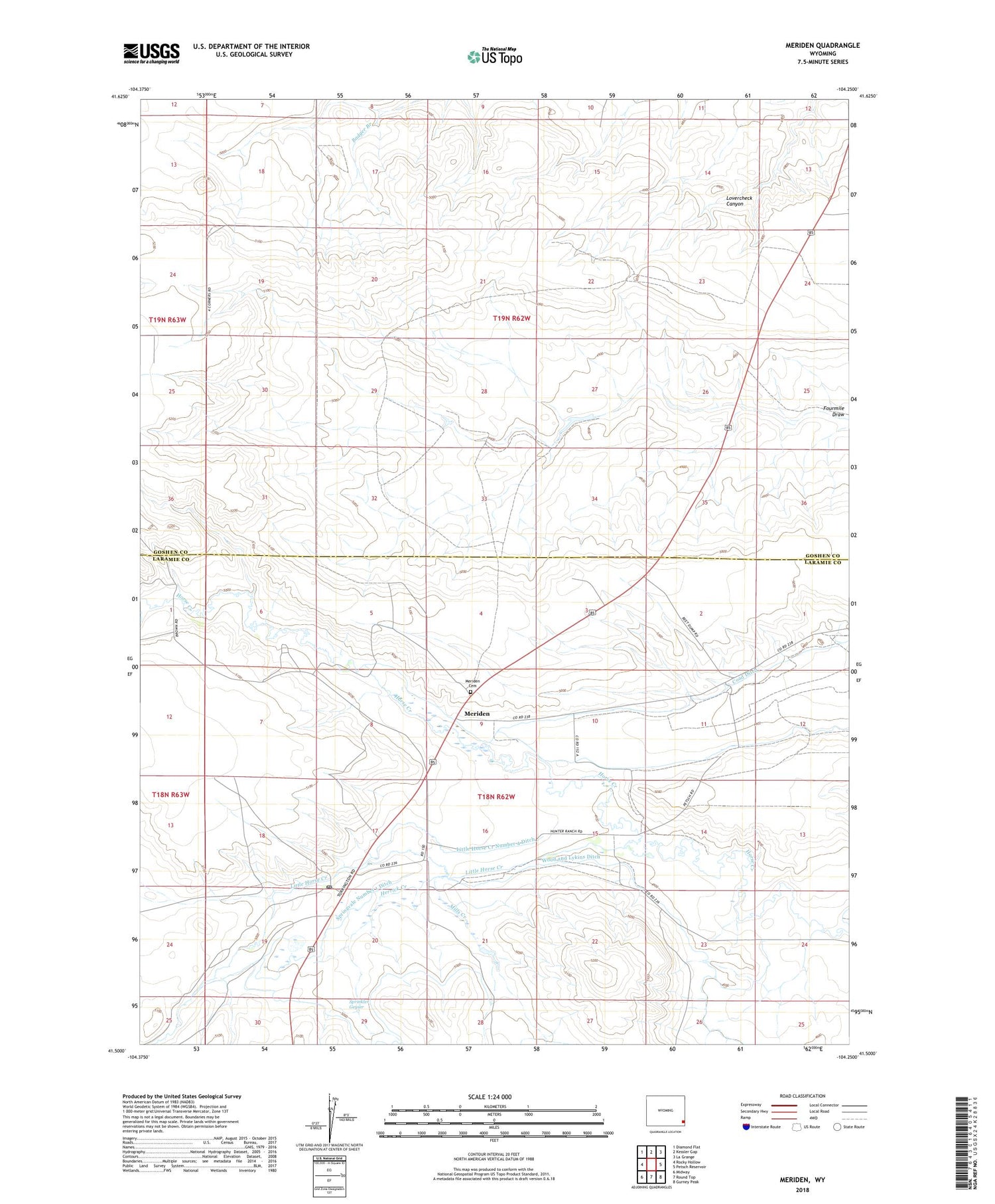
2021 topographic map quadrangle Meriden in the state of Wyoming. Scale: 1:24000. Based on the newly updated USGS 7.5' US Topo map series, this map is in the following counties: Laramie, Goshen. The map contains contour data, water features, and other items you are used to seeing on USGS maps, but also has updated roads and other features. This is the next generation of topographic maps. Printed on high-quality waterproof paper with UV fade-resistant inks.
Quads adjacent to this one:
West: Rocky Hollow
Northwest: Diamond Flat
North: Kessler Gap
Northeast: La Grange
East: Petsch Reservoir
Southeast: Gurney Peak
South: Round Top
Southwest: Midway
Contains the following named places: Brown Ranch, Coad Dam, Coad Reservoir, E-7 Ranch, Herrick Creek, Hunter Ranch, Little Horse Creek, Little Horse Creek Number 4 Ditch, Meriden, Meriden Cemetery, Meriden Post Office, Mills Creek, Morrie Ranch, Petsch Ranch, Springvale Ditch, Springvale Number 1 Ditch, Springvale Number 2 Ditch, Sprinkler Geyser, Wood and Lykins Ditch