MyTopo
Kessler Gap Wyoming US Topo Map
Couldn't load pickup availability
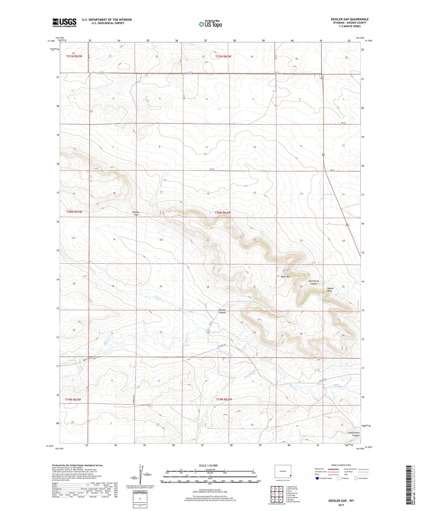
2023 topographic map quadrangle Kessler Gap in the state of Wyoming. Scale: 1:24000. Based on the newly updated USGS 7.5' US Topo map series, this map is in the following counties: Goshen. The map contains contour data, water features, and other items you are used to seeing on USGS maps, but also has updated roads and other features. This is the next generation of topographic maps. Printed on high-quality waterproof paper with UV fade-resistant inks.
Quads adjacent to this one:
West: Diamond Flat
Northwest: Needle Rock
North: Hawk Springs
Northeast: Duroc
East: La Grange
Southeast: Petsch Reservoir
South: Meriden
Southwest: Rocky Hollow
This map covers the same area as the classic USGS quad with code o41104f3.
Contains the following named places: Atterberry Canyon, Babbitt Dam, Babbitt Reservoir, Badger Branch, Bear Creek Ditch, Bear Mountain, Dater Creek, Fox Creek, Kessler Canyon, Kessler Ditch, Kessler Gap, Lovercheck Ditch, Squaw Rock, ZIP Code: 82221