MyTopo
La Grange Wyoming US Topo Map
Couldn't load pickup availability
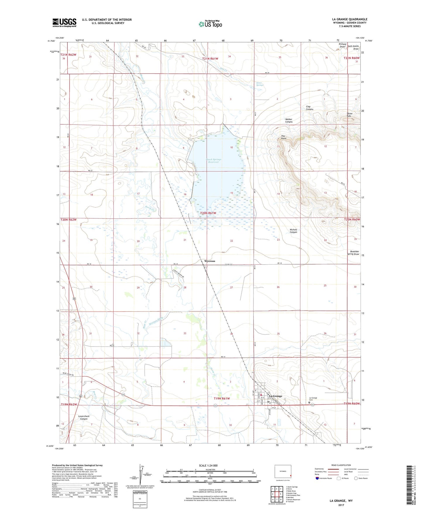
2021 topographic map quadrangle La Grange in the state of Wyoming. Scale: 1:24000. Based on the newly updated USGS 7.5' US Topo map series, this map is in the following counties: Goshen. The map contains contour data, water features, and other items you are used to seeing on USGS maps, but also has updated roads and other features. This is the next generation of topographic maps. Printed on high-quality waterproof paper with UV fade-resistant inks.
Quads adjacent to this one:
West: Kessler Gap
Northwest: Hawk Springs
North: Duroc
Northeast: Robb Draw
East: McCompsey Pass
Southeast: Tremain
South: Petsch Reservoir
Southwest: Meriden
This map covers the same area as the classic USGS quad with code o41104f2.
Contains the following named places: Bear Creek, C P Ranch, Clay Canyon, Hawk Springs, Hawk Springs Dam Number 1, Hawk Springs Reservoir, Kincaid Draw, La Grange, La Grange Cemetery, La Grange Post Office, La Grange School, LaGrange Fire Department, Nichols Canyon, The Point, Three Tubs, Town of LaGrange, Walker Canyon, Wycross, Wycross Ditch, Wycross Ranch, Zenor Springs