MyTopo
Middlewood Hill Wyoming US Topo Map
Couldn't load pickup availability
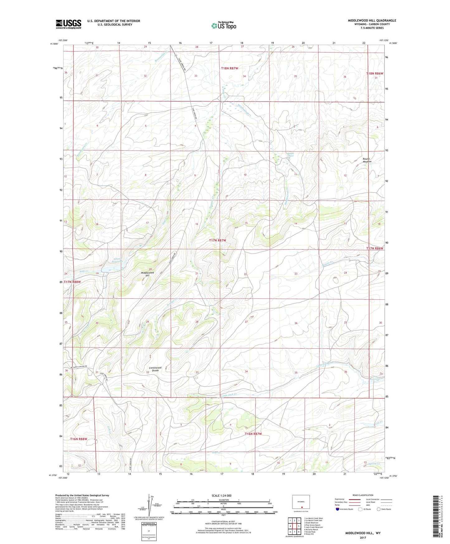
2021 topographic map quadrangle Middlewood Hill in the state of Wyoming. Scale: 1:24000. Based on the newly updated USGS 7.5' US Topo map series, this map is in the following counties: Carbon. The map contains contour data, water features, and other items you are used to seeing on USGS maps, but also has updated roads and other features. This is the next generation of topographic maps. Printed on high-quality waterproof paper with UV fade-resistant inks.
Quads adjacent to this one:
West: Pine Grove Ranch
Northwest: La Marsh Creek West
North: La Marsh Creek East
Northeast: Kindt Reservoir
East: Jack Creek Reservoir
Southeast: Sharp Hill
South: Divide Peak
Southwest: McCarty Ranch
This map covers the same area as the classic USGS quad with code o41107d2.
Contains the following named places: Adams Dam, Adams Reservoir, Low Dam, Low Reservoir, Middlewood Creek, Middlewood Hill, Middlewood Ranch, Midget Geyser, Round Meadow, Trapper Creek