MyTopo
McCarty Ranch Wyoming US Topo Map
Couldn't load pickup availability
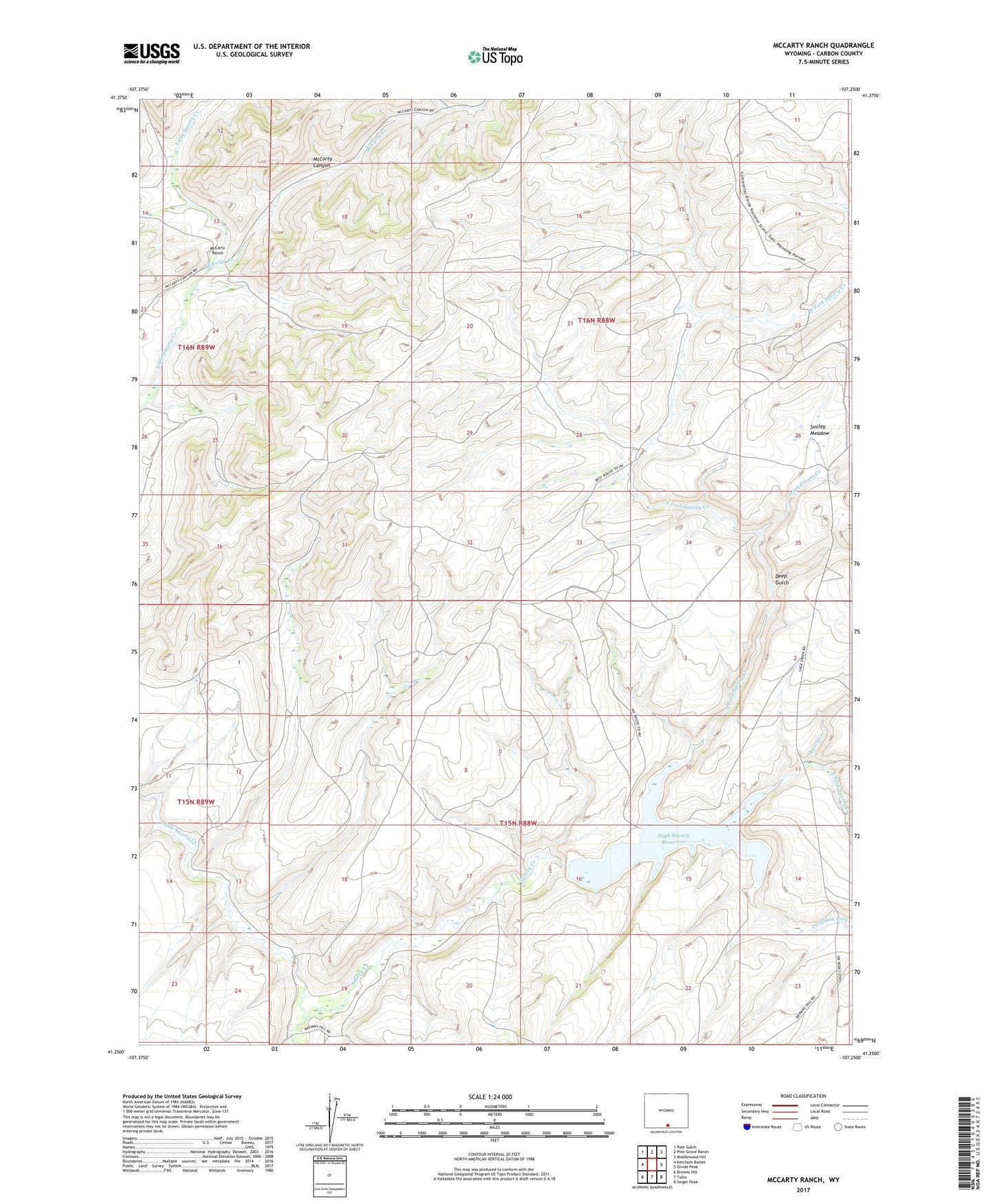
2021 topographic map quadrangle McCarty Ranch in the state of Wyoming. Scale: 1:24000. Based on the newly updated USGS 7.5' US Topo map series, this map is in the following counties: Carbon. The map contains contour data, water features, and other items you are used to seeing on USGS maps, but also has updated roads and other features. This is the next generation of topographic maps. Printed on high-quality waterproof paper with UV fade-resistant inks.
Quads adjacent to this one:
West: Ketchum Buttes
Northwest: Pole Gulch
North: Pine Grove Ranch
Northeast: Middlewood Hill
East: Divide Peak
Southeast: Singer Peak
South: Tullis
Southwest: Browns Hill
This map covers the same area as the classic USGS quad with code o41107c3.
Contains the following named places: Deep Gulch, Dirtyman Fork, East Fork Savery Creek, Fence V A B M, Hartt Creek, High Savery Dam, High Savery Reservoir, Little Savery Creek, McCarty Canyon, McCarty Creek, McCarty Ranch, North Fork Savery Creek, Smiley Meadow, Sundin Johnson Ranch, Truckdrivers Creek