MyTopo
Missouri Buttes Wyoming US Topo Map
Couldn't load pickup availability
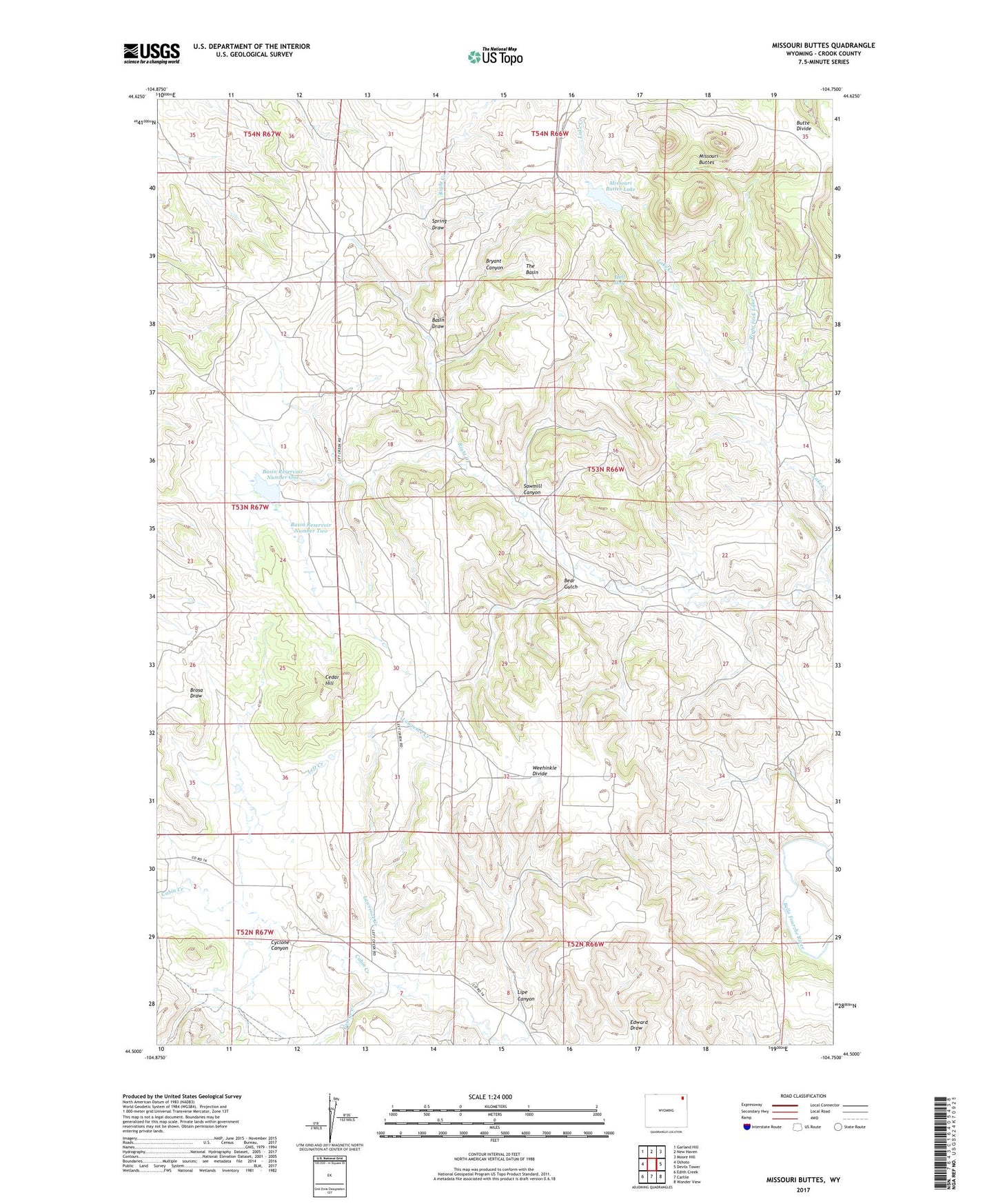
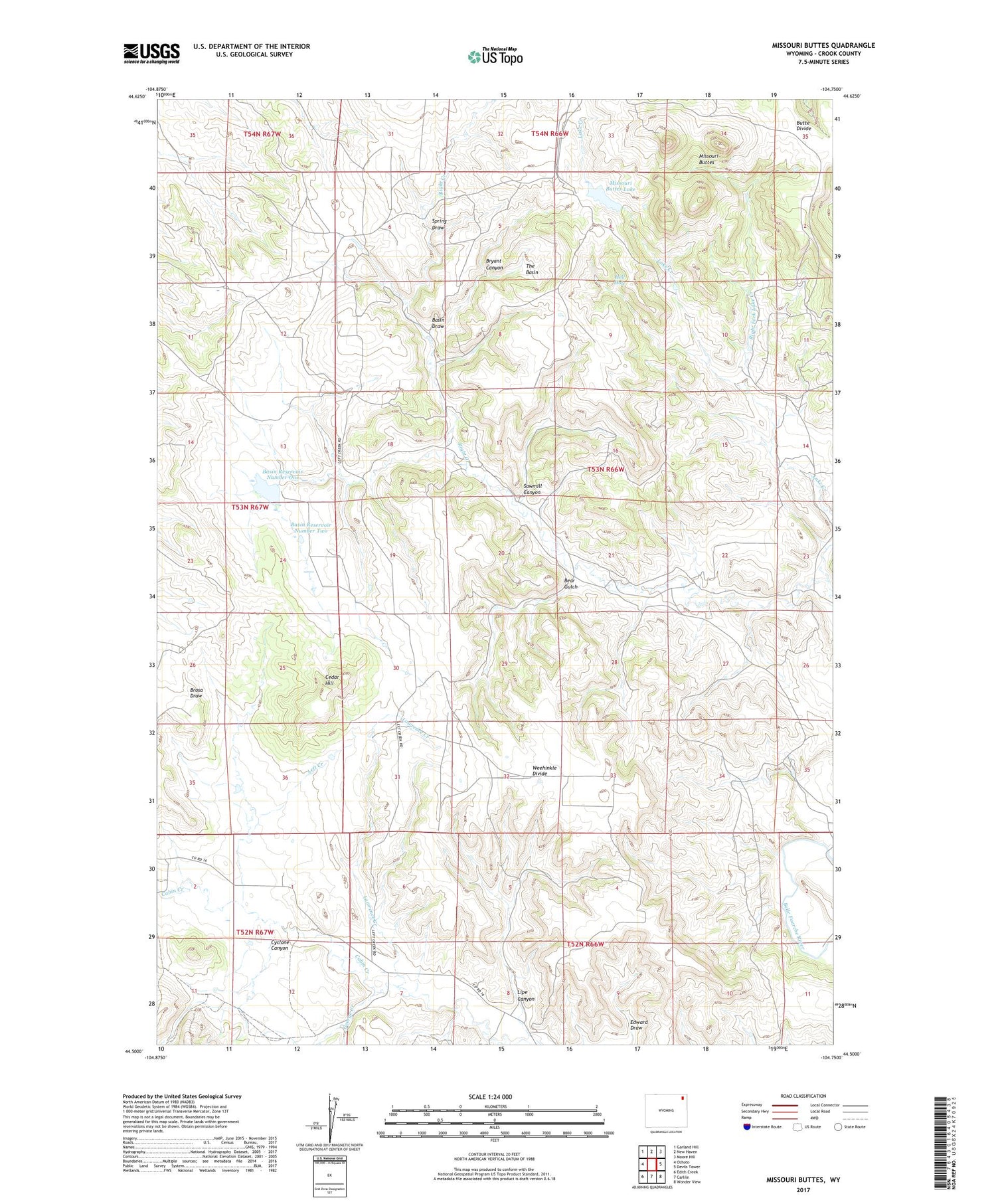
2021 topographic map quadrangle Missouri Buttes in the state of Wyoming. Scale: 1:24000. Based on the newly updated USGS 7.5' US Topo map series, this map is in the following counties: Crook. The map contains contour data, water features, and other items you are used to seeing on USGS maps, but also has updated roads and other features. This is the next generation of topographic maps. Printed on high-quality waterproof paper with UV fade-resistant inks.
Quads adjacent to this one:
West: Oshoto
Northwest: Garland Hill
North: New Haven
Northeast: Moore Hill
East: Devils Tower
Southeast: Wonder View
South: Carlile
Southwest: Edith Creek
Contains the following named places: Basin Draw, Basin Number 1 Dam, Basin Number 2 Dam, Basin Reservoir Number One, Basin Reservoir Number Two, Bear Gulch, Bryant Canyon, Butte School, Cedar Hill, Cyclone Canyon, Dutch Creek, Edward Draw, George Creek, Hell Hole, Lake Creek, Lake Ranch School, Lawrence Creek, Lipe Canyon, Lower Cabin Creek School, Missouri Buttes, Missouri Buttes Lake, Red Rock One Mine, Red Rock Two Mine, Right Creek, Right Fork Lake Creek, Sand Lode Four, Sawmill Canyon, Spring Draw, The Basin, Weehinkle Divide