MyTopo
Oshoto Wyoming US Topo Map
Couldn't load pickup availability
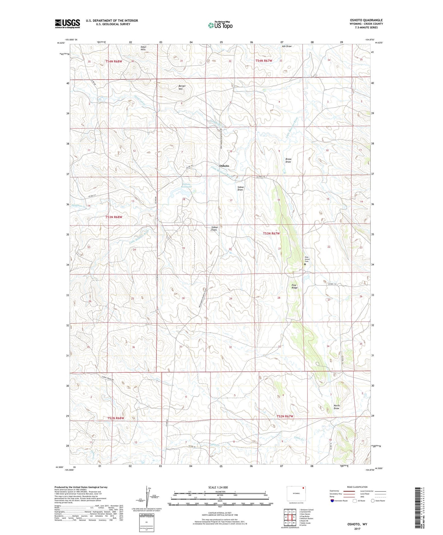
2021 topographic map quadrangle Oshoto in the state of Wyoming. Scale: 1:24000. Based on the newly updated USGS 7.5' US Topo map series, this map is in the following counties: Crook. The map contains contour data, water features, and other items you are used to seeing on USGS maps, but also has updated roads and other features. This is the next generation of topographic maps. Printed on high-quality waterproof paper with UV fade-resistant inks.
Quads adjacent to this one:
West: Flag Butte
Northwest: Brislawn School
North: Garland Hill
Northeast: New Haven
East: Missouri Buttes
Southeast: Carlile
South: Edith Creek
Southwest: Rozet NE
This map covers the same area as the classic USGS quad with code o44104e8.
Contains the following named places: Ash Draw, Berger Hill, Brosa Draw, Cabin Creek Four Mine, Cabin Creek Seven Mine, Deadman Creek, Good Lad Creek, North Draw, Oshoto, Oshoto Dam, Oshoto Reservoir, Oshoto School, Pine Grove Cemetery, Pine Grove Chapel, Pine Ridge, Sidner Draw, Sidner Flats