MyTopo
Morrison Canyon Wyoming US Topo Map
Couldn't load pickup availability
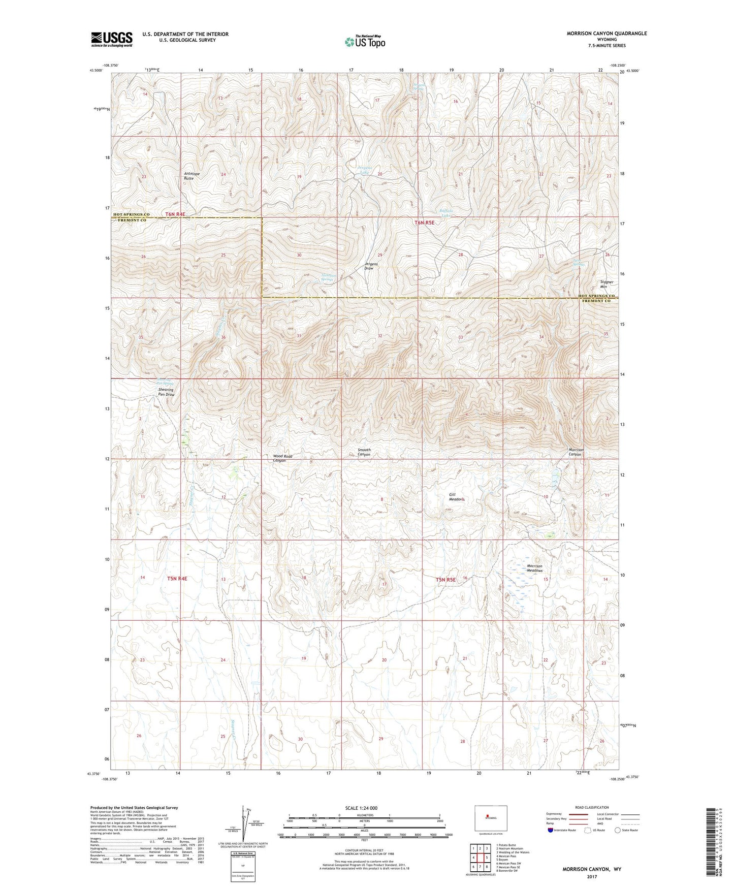
2021 topographic map quadrangle Morrison Canyon in the state of Wyoming. Scale: 1:24000. Based on the newly updated USGS 7.5' US Topo map series, this map is in the following counties: Fremont, Hot Springs. The map contains contour data, water features, and other items you are used to seeing on USGS maps, but also has updated roads and other features. This is the next generation of topographic maps. Printed on high-quality waterproof paper with UV fade-resistant inks.
Quads adjacent to this one:
West: Mexican Pass
Northwest: Potato Butte
North: Nostrum Mountain
Northeast: Wedding of the Waters
East: Boysen
Southeast: Bonneville SW
South: Mexican Pass SE
Southwest: Mexican Pass SW
Contains the following named places: Antelope Butte, Bean Ranch, Buffalo Lake, Burgess Ranch, Elk Lake, Gill Meadows, Jergens Lake, Jergens Spring, Morrison Canyon, Morrison Meadows, Nicholson Springs, Shearing Pen Spring, Smooth Canyon, Twin Springs, Wood Road Canyon