MyTopo
Wedding of the Waters Wyoming US Topo Map
Couldn't load pickup availability
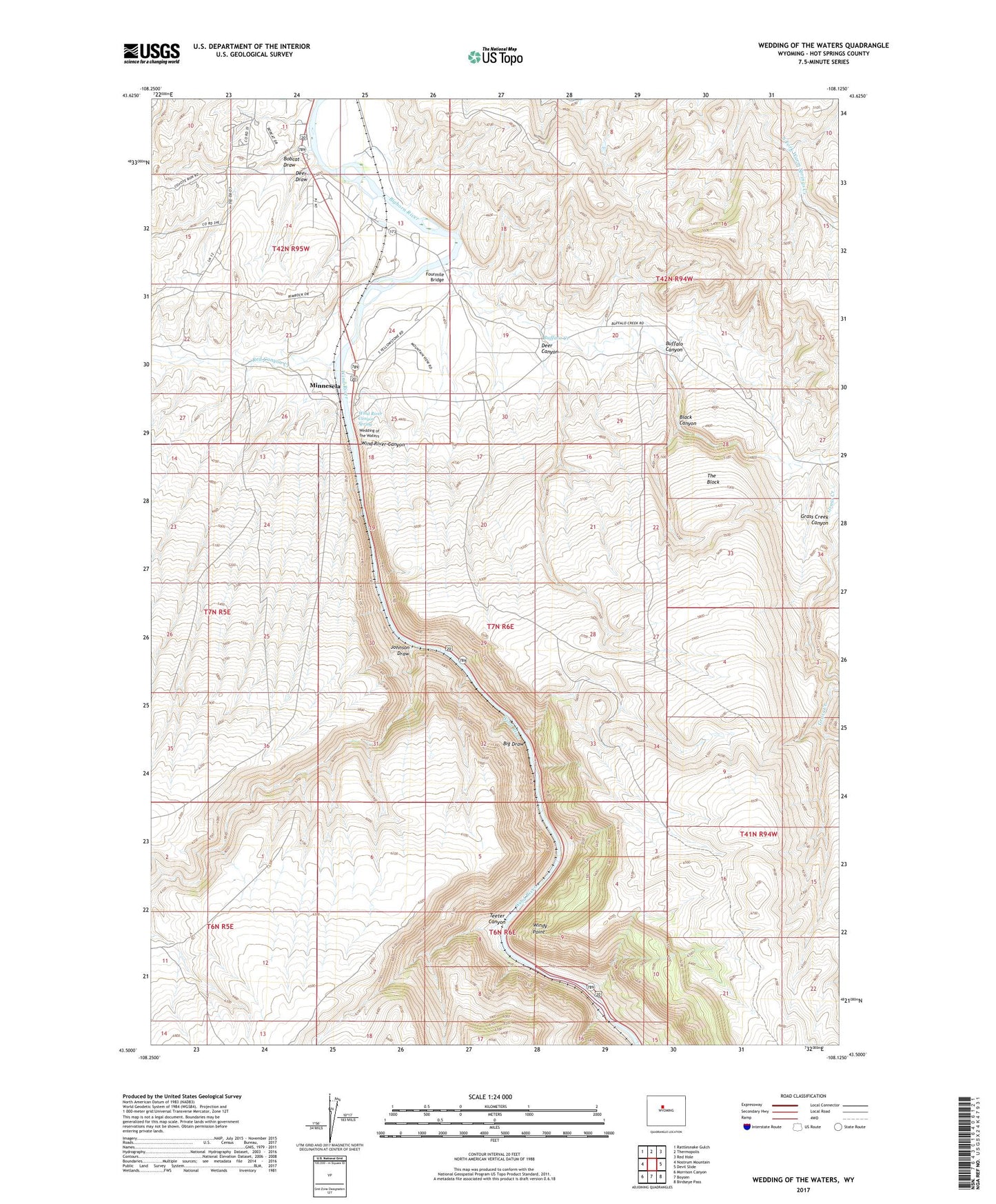
2021 topographic map quadrangle Wedding of the Waters in the state of Wyoming. Scale: 1:24000. Based on the newly updated USGS 7.5' US Topo map series, this map is in the following counties: Hot Springs. The map contains contour data, water features, and other items you are used to seeing on USGS maps, but also has updated roads and other features. This is the next generation of topographic maps. Printed on high-quality waterproof paper with UV fade-resistant inks.
Quads adjacent to this one:
West: Nostrum Mountain
Northwest: Rattlesnake Gulch
North: Thermopolis
Northeast: Red Hole
East: Devil Slide
Southeast: Birdseye Pass
South: Boysen
Southwest: Morrison Canyon
This map covers the same area as the classic USGS quad with code o43108e2.
Contains the following named places: Big Draw, Black Canyon, Bobcat Draw, Buffalo Canyon, Buffalo Creek, Deer Canyon, Deer Draw, Fourmile Bridge, Grass Creek, Grass Creek Canyon, Johnson Draw, Jones Dam, Jones Reservoir, Minnesela, Red Canyon Creek, Talovich Mine, Teeter Canyon, The Block, Wedding of the Waters, Wind River, Wind River Canyon, Wind River Canyon Spring, Windy Point