MyTopo
Mule Butte Wyoming US Topo Map
Couldn't load pickup availability
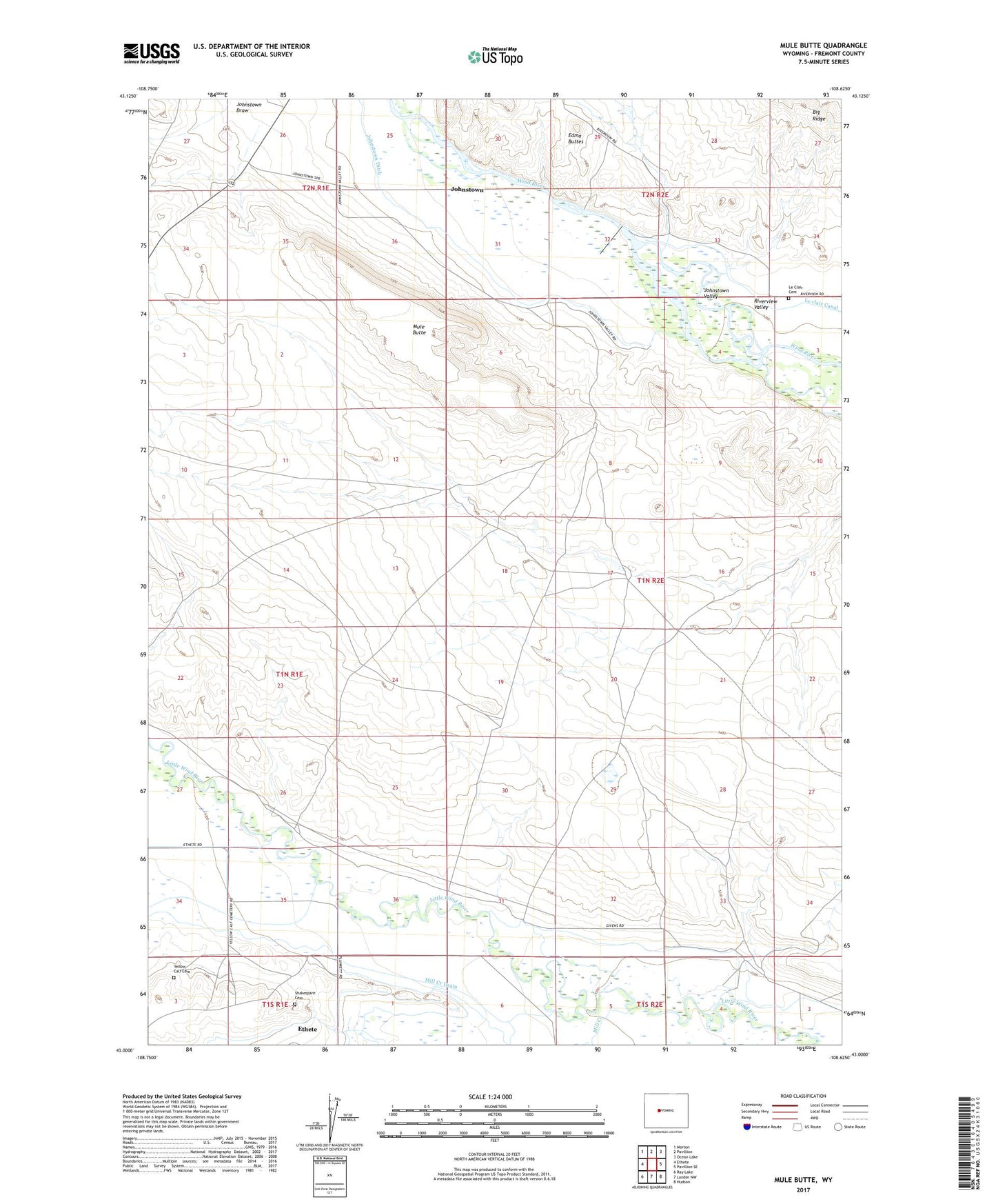
2021 topographic map quadrangle Mule Butte in the state of Wyoming. Scale: 1:24000. Based on the newly updated USGS 7.5' US Topo map series, this map is in the following counties: Fremont. The map contains contour data, water features, and other items you are used to seeing on USGS maps, but also has updated roads and other features. This is the next generation of topographic maps. Printed on high-quality waterproof paper with UV fade-resistant inks.
Quads adjacent to this one:
West: Ethete
Northwest: Morton
North: Pavillion
Northeast: Ocean Lake
East: Pavillion SE
Southeast: Hudson
South: Lander NW
Southwest: Ray Lake
Contains the following named places: Blackburn Ditch, Edmo Buttes, Ethete Census Designated Place, Fremont County, Johnstown, Johnstown Census Designated Place, Johnstown Ditch, Johnstown Draw, Johnstown Valley, Le Clair Cemetery, Le clair Diversion Dam, Mill Creek, Mill Creek Drain, Mule Butte, Shakespare Cemetery, Yellow Calf Cemetery