MyTopo
Pavillion Wyoming US Topo Map
Couldn't load pickup availability
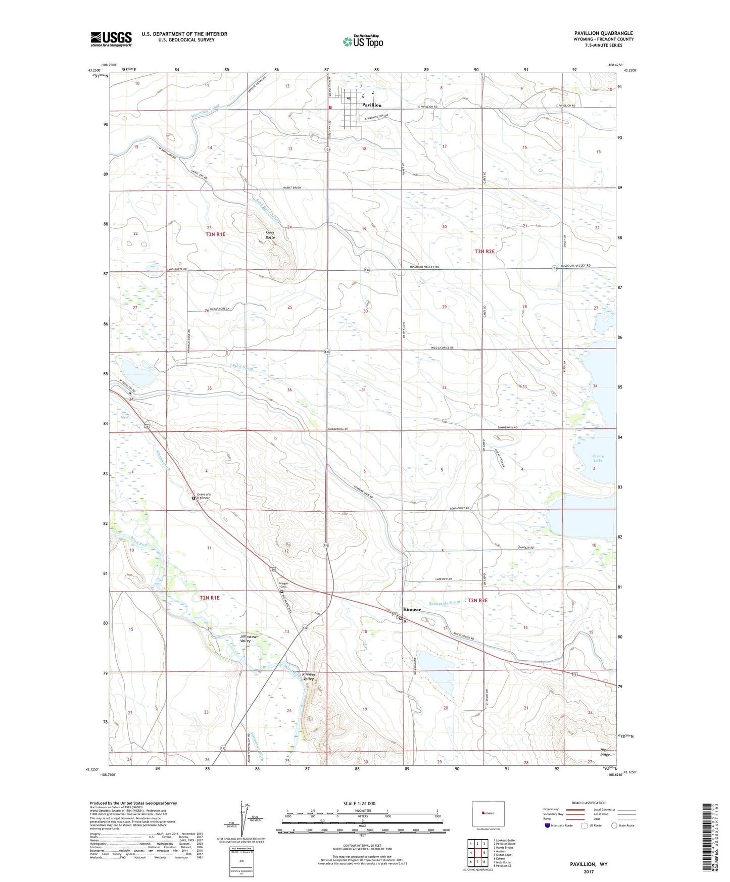
2021 topographic map quadrangle Pavillion in the state of Wyoming. Scale: 1:24000. Based on the newly updated USGS 7.5' US Topo map series, this map is in the following counties: Fremont. The map contains contour data, water features, and other items you are used to seeing on USGS maps, but also has updated roads and other features. This is the next generation of topographic maps. Printed on high-quality waterproof paper with UV fade-resistant inks.
Quads adjacent to this one:
West: Morton
Northwest: Lookout Butte
North: Pavillion Butte
Northeast: Harris Bridge
East: Ocean Lake
Southeast: Pavillion SE
South: Mule Butte
Southwest: Ethete
This map covers the same area as the classic USGS quad with code o43108b6.
Contains the following named places: Aragon Cemetery, Big Ridge, Fremont County Fire Protection District Battalion 5 Morton - Kinnear, Fremont County Fire Protection District Battalion 7 Pavillion, Grave of N B Kinnear, Kinnear, Kinnear Post Office, Kinnear Valley, Morton School, Pavillion, Pavillion Post Office, Pilot Drain, Saint Edwards Church, Sand Butte, Sand Butte Lateral, Sunnyside Church, Sunnyside Drain, Town of Pavillion, Wind River High School, Wind River Middle School, Wind River School