MyTopo
Ray Lake Wyoming US Topo Map
Couldn't load pickup availability
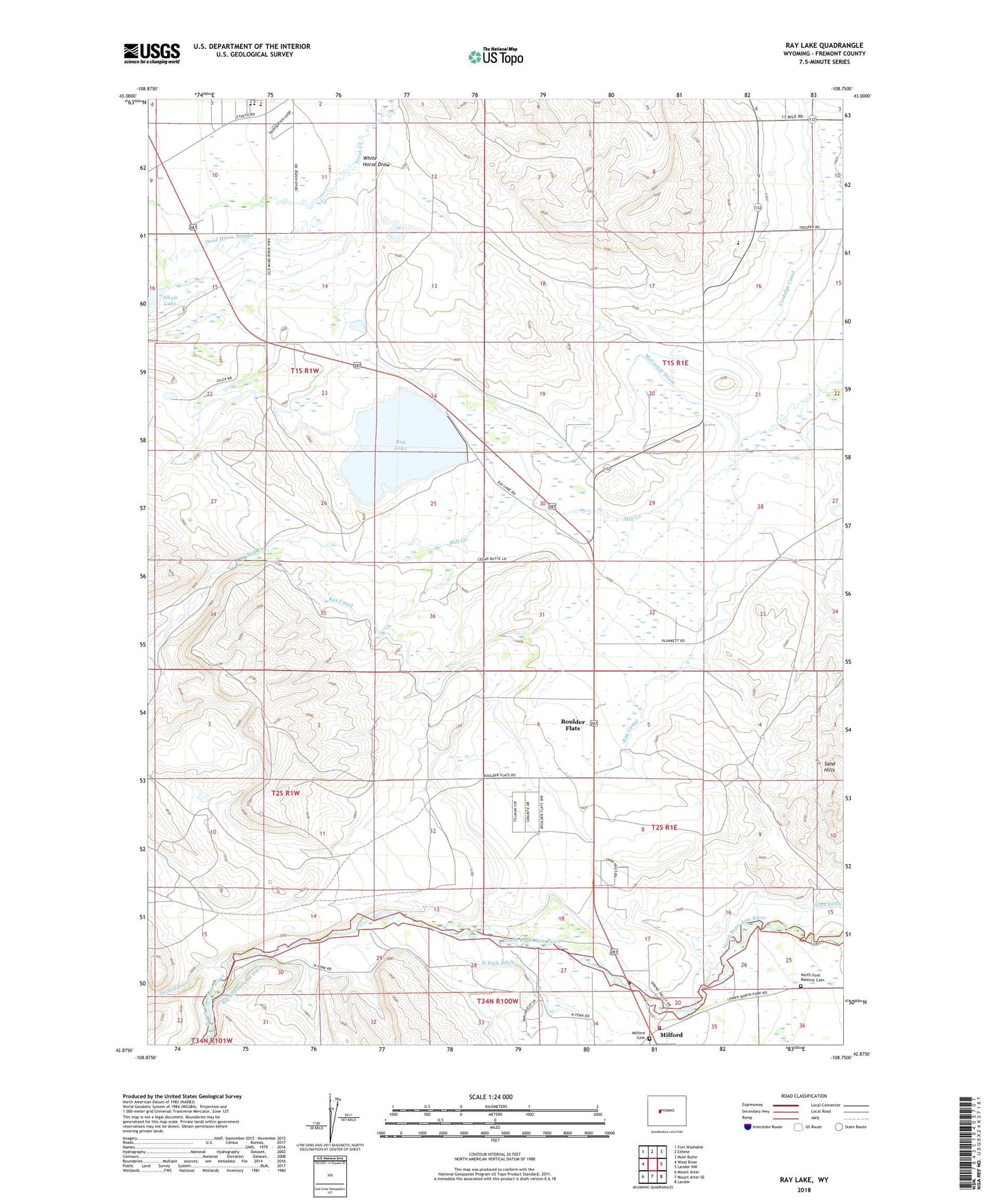
2021 topographic map quadrangle Ray Lake in the state of Wyoming. Scale: 1:24000. Based on the newly updated USGS 7.5' US Topo map series, this map is in the following counties: Fremont. The map contains contour data, water features, and other items you are used to seeing on USGS maps, but also has updated roads and other features. This is the next generation of topographic maps. Printed on high-quality waterproof paper with UV fade-resistant inks.
Quads adjacent to this one:
West: Wind River
Northwest: Fort Washakie
North: Ethete
Northeast: Mule Butte
East: Lander NW
Southeast: Lander
South: Mount Arter SE
Southwest: Mount Arter
This map covers the same area as the classic USGS quad with code o42108h7.
Contains the following named places: Boulder Flats, Boulder Flats Census Designated Place, Coolidge Canal, Dead Horse Slough, Fort Washakie Elementary / Middle School, Fort Washakie Elementary School, Fremont County Fire Protection District Battalion 3 Lander Rural Station 2, Latter Day Saints Church, McCaskey Drain, Milford, Milford Cemetery, North Fork Masonic Cemetery, Ray Canal, Ray Dam, Ray Lake, Ray Reservoir, Surrell Creek, Upper Milford School, Upper Mill Creek School, White Horse Draw, Wind River Day School, Wind River Mountain Front Number Six Mine, Wind River Mountain Front Number Three Mine, Wyoming Indian Elementary School