MyTopo
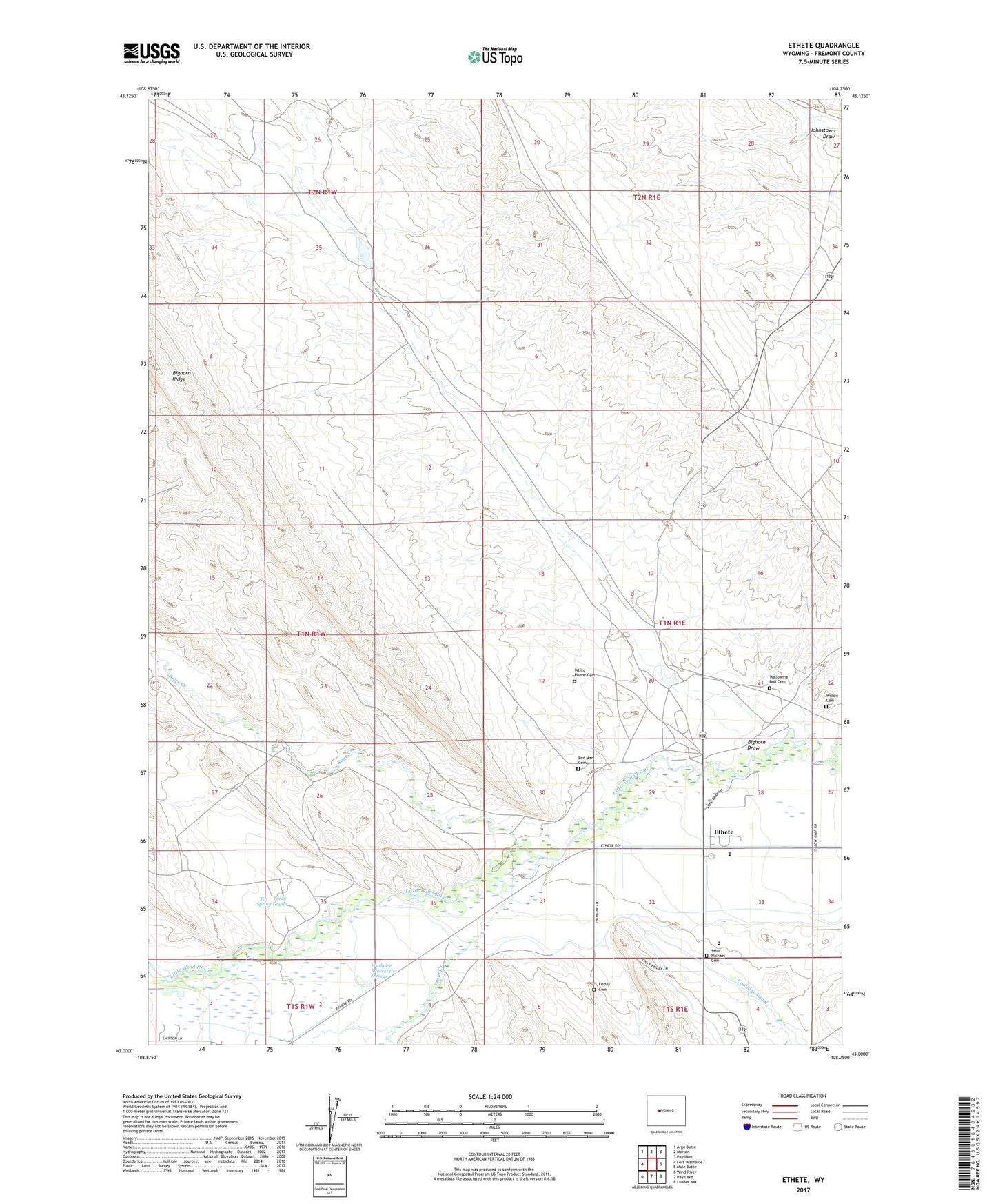
Ethete Wyoming US Topo Map
Couldn't load pickup availability
2021 topographic map quadrangle Ethete in the state of Wyoming. Scale: 1:24000. Based on the newly updated USGS 7.5' US Topo map series, this map is in the following counties: Fremont. The map contains contour data, water features, and other items you are used to seeing on USGS maps, but also has updated roads and other features. This is the next generation of topographic maps. Printed on high-quality waterproof paper with UV fade-resistant inks.
Quads adjacent to this one:
West: Fort Washakie
Northwest: Argo Butte
North: Morton
Northeast: Pavillion
East: Mule Butte
Southeast: Lander NW
South: Ray Lake
Southwest: Wind River
This map covers the same area as the classic USGS quad with code o43108a7.
Contains the following named places: Bighorn Draw, Bighorn Ridge, Coolidge Turnout, Ethete, Ethete Number One Mine, Ethete Number Two Mine, Fort Washakie Hot Spring Mine, Friday Cemetery, Sage - Red Man Cemetery, Sage Creek, Sage Creek Anticline Mine, Saint James Church, Saint Michael Mission Cemetery, Tar Spring, Tardy Geyser, Trout Creek, Wallowing Bull Cemetery, Washakie Mineral Hot Springs, White Plume Cemetery, Willow Cemetery, Wind River Indian Reservation Number One Mine, Wyoming Indian High School, Wyoming Indian Middle School