MyTopo
Needle Rock Wyoming US Topo Map
Couldn't load pickup availability
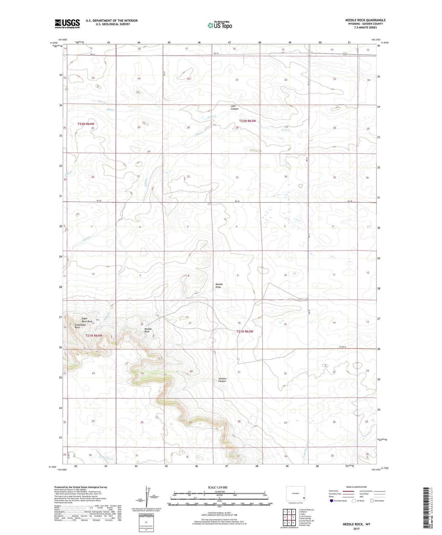
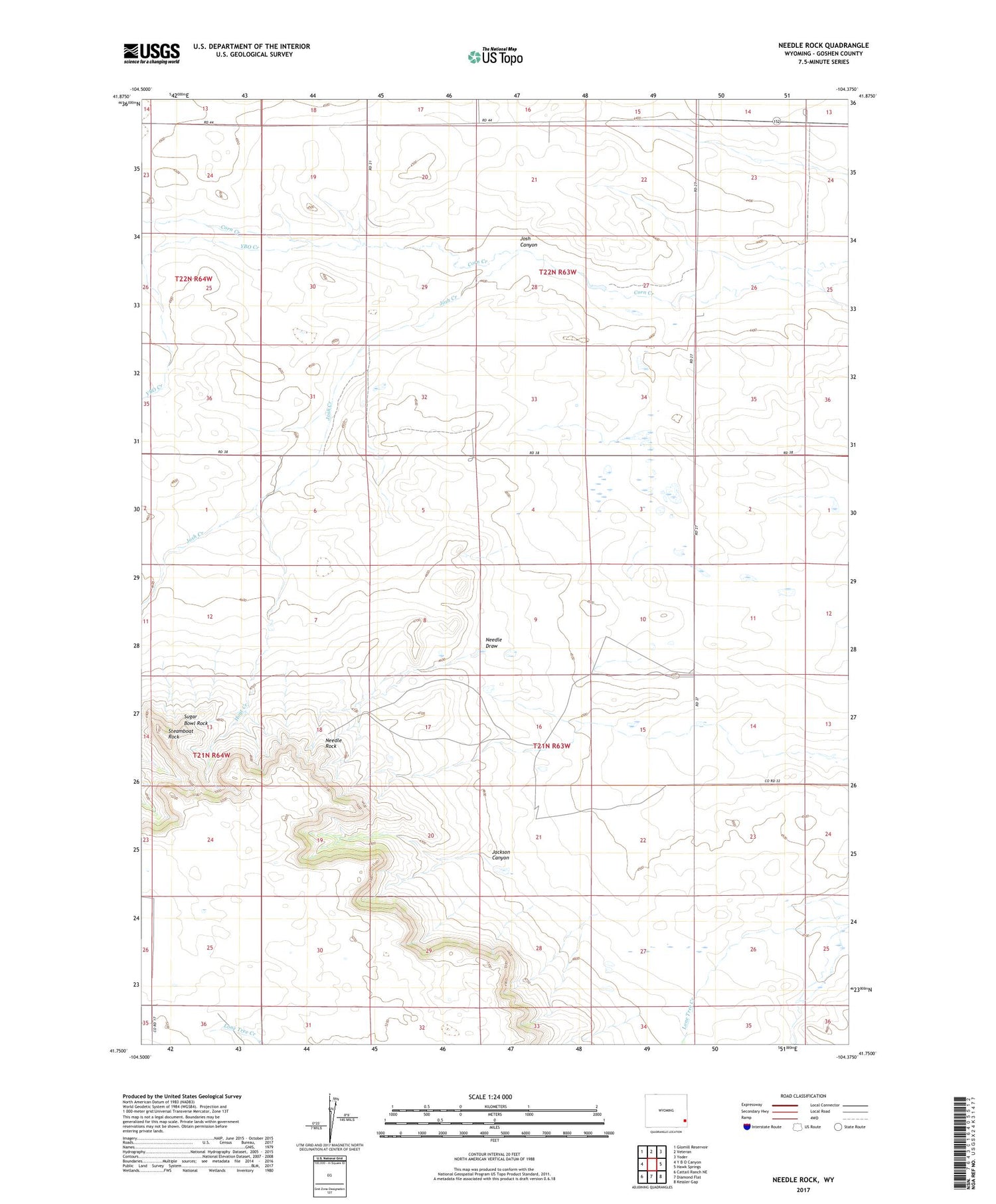
2021 topographic map quadrangle Needle Rock in the state of Wyoming. Scale: 1:24000. Based on the newly updated USGS 7.5' US Topo map series, this map is in the following counties: Goshen. The map contains contour data, water features, and other items you are used to seeing on USGS maps, but also has updated roads and other features. This is the next generation of topographic maps. Printed on high-quality waterproof paper with UV fade-resistant inks.
Quads adjacent to this one:
West: Y B O Canyon
Northwest: Glomill Reservoir
North: Veteran
Northeast: Yoder
East: Hawk Springs
Southeast: Kessler Gap
South: Diamond Flat
Southwest: Cattail Ranch NE
Contains the following named places: Goshen Hole Division, Hoyt Creek, Hunter Ranch, Jackson Canyon, Josh Canyon, Josh Creek, Needle Draw, Needle Rock, Otto Ranch, Steamboat Rock, Sugar Bowl Rock, Trelona, Wilkins Ranch, YBO Creek