MyTopo
Yoder Wyoming US Topo Map
Couldn't load pickup availability
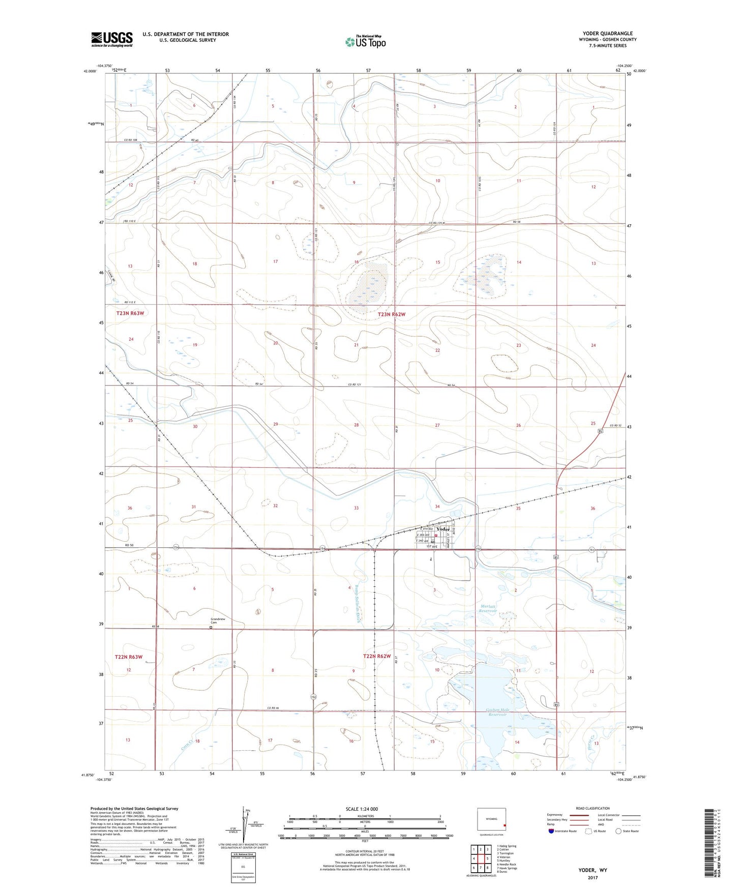
2021 topographic map quadrangle Yoder in the state of Wyoming. Scale: 1:24000. Based on the newly updated USGS 7.5' US Topo map series, this map is in the following counties: Goshen. The map contains contour data, water features, and other items you are used to seeing on USGS maps, but also has updated roads and other features. This is the next generation of topographic maps. Printed on high-quality waterproof paper with UV fade-resistant inks.
Quads adjacent to this one:
West: Veteran
Northwest: Habig Spring
North: Cottier
Northeast: Torrington
East: Huntley
Southeast: Duroc
South: Hawk Springs
Southwest: Needle Rock
This map covers the same area as the classic USGS quad with code o41104h3.
Contains the following named places: Bump Sullivan Ditch, Cherry Creek Lateral, Corn Creek, Fort Laramie Ditch, Goshen Hole Ditch, Goshen Hole Reservoir, Grandview Cemetery, Greasewood Dam, Greasewood Ranch, Greasewood Reservoir, Marlatt Dam, Marlatt Reservoir, Perchal Drain, Silver Tip, Southeast High School, Southeast Junior High School, Southeast School, Springer Reservoir, Springer Reservoir Dam, Town of Yoder, Yoder, Yoder Ambulance, Yoder Post Office, Yoder Volunteer Fire Department